


DELMARVA -- High pressure continues to dominate Delmarva through Sunday night, delivering clear skies and calm conditions. As clouds gradually rebuild toward daybreak Monday, they’ll help temper overnight cooling. Lows will dip into the 40s to low 50s.

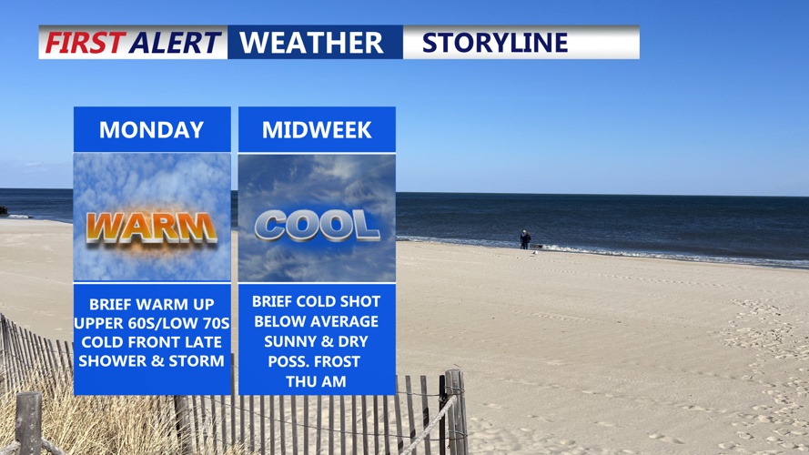
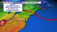
Temperatures rise back into the upper 60s to low 70s Monday on Delmarva.
The start of the workweek brings a noticeable warming trend. A warm front lifting in from the southwest will boost highs into the upper 60s to low 70s. Expect increasing cloud cover throughout the day. By Monday evening, showers will begin to move in as a cold front approaches from the west.
Although instability will be limited after sunset, the Storm Prediction Center has placed Kent, Queen Anne’s, and Talbot counties under a Marginal Risk for severe weather, primarily due to the potential for damaging winds. However, a strong surface inversion may limit this threat.

Showers & storms possible late Monday night into early Tuesday, some brief downpours/gusty winds possible.
Rainfall will be brief but potentially moderate, with totals between 0.10” and 0.25”. Temperatures Monday night will remain mild, ranging from the upper 40s to mid-50s.
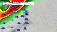
As the front moves offshore Tuesday morning, Delmarva falls under the influence of an upper-level trough. This will bring gusty northwest winds—potentially reaching 40 mph—and cooler temperatures. Highs will range from the upper 50s to mid-60s. Some lingering moisture may spark isolated showers, particularly along the coast during the morning.
By Tuesday night, a secondary cold front will sweep through dry but reinforce the cool air mass.

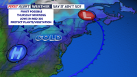
Another cold front passing Tuesday night brings unseasonably cooler air Wednesday-Thursday
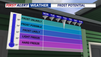
High pressure returns midweek, bringing sunny skies and drier air. Expect crisp mornings with lows in the mid 30s, raising the possibility of frost in areas where the growing season has begun especially Thursday morning.

Not out of the question for the chance of frost come Thursday morning.
Highs Wednesday will hover in the 40s and 50s, gradually warming to the 50s and 60s by Thursday and Friday.
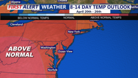
By Friday night, conditions begin to change once more. Another low-pressure system will approach from the Great Lakes, bringing a warm front late Friday followed by a cold front Saturday night. Showers are likely during this period, with rain chances ranging from 20% to 50%. Temperatures, however, will be notably warm for April—potentially reaching the mid to upper 70s on Saturday and upper 60s to low 70s Easter Sunday.

Looking at above average temperatures Easter Weekend onward.