


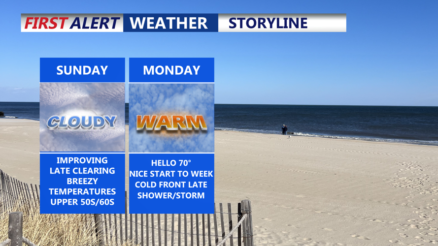


DELMARVA -- A mostly dry Sunday as both surface and upper-level low pressure systems continue to shift away from the region. Despite the improving conditions, skies will remain largely cloudy throughout the day, with a better chance of some sunshine breaking through by afternoon. Highs will range from the upper 50s to low 60s.
By Sunday night, an upper-level ridge will begin building into the area, helping to stabilize the atmosphere. Temperatures will drop into the upper 30s to mid 40s under partly cloudy skies.

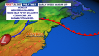
Warm front lifts through Sunday night, temperatures rise to near 70 Monday.
Monday starts off tranquil with continued cloud cover and noticeably warmer temperatures thanks to a return of southerly winds. Highs are forecast to reach into the 60s, with some spots nearing 70 degrees.
The calm pattern will be interrupted by a cold front moving in from the west late Monday. Scattered showers and isolated thunderstorms are expected to develop, most likely after sunset. Confidence in severe weather remains low, with machine learning guidance suggesting only a 10% chance of any severe storms. Rain and storms should taper off by early Tuesday morning, as the system exits from northwest to southeast.
Tuesday brings drier air and breezy conditions in the wake of the cold front. Expect a mix of sun and clouds with highs in the upper 50s to mid 60s. Westerly winds will increase during the afternoon, with gusts up to 30 to 35 mph possible.
Another, drier cold front will sweep through the region Tuesday night, reinforcing the cooler air mass. No precipitation is expected with this secondary front, but temperatures will dip noticeably. From Tuesday night through Thursday night, temperatures are projected to run about 5 to 10 degrees below average. Overnight lows may approach levels favorable for frost or a light freeze, especially in rural areas.
High pressure will dominate the region through Friday, bringing mostly sunny skies and gradually moderating temperatures. A new weather system is expected to approach Delmarva by Friday night or Saturday, bringing the next chance of rain and a return to above-normal temperatures for the weekend.
