What To Expect

A cold front will bring the chance for scattered showers and a thunderstorm this evening. 

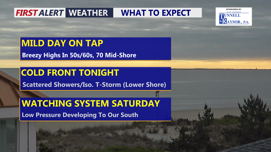
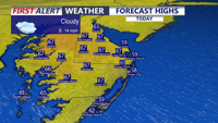
DELMARVA -- Cloudy skies will stay in place across Delmarva today, but temperatures will still climb to mild levels for late April. Highs will reach the upper 50s to low 60s at the beaches, while inland areas warm into the mid and upper 60s. A few communities on the Mid-Shore may briefly reach the 70-degree mark.

Forecast Highs

Highs to day in the mid to upper 60s, upper 50s to ow 60s at the beaches.

A developing weather system will begin to influence the region later today and tonight. A deepening upper-level trough and closed low over the Upper Great Lakes will pivot eastward through Thursday, helping a surface low form across the Ohio Valley before moving east-northeast overnight. A strong cold front will follow and move through Delmarva early Thursday morning.

Futurecast

Scattered showers and a rumble of thunder possible into the evening and overnight.

Ahead of the front, scattered showers and an isolated thunderstorm are expected this evening through the overnight hours. Rainfall totals have trended lower, but many areas may still pick up around a quarter inch to three-quarters of an inch of rain through early Thursday morning. The severe weather threat remains limited and has shifted farther southwest, but lower Delmarva could still see an isolated strong to severe storm, with damaging winds as the main concern.

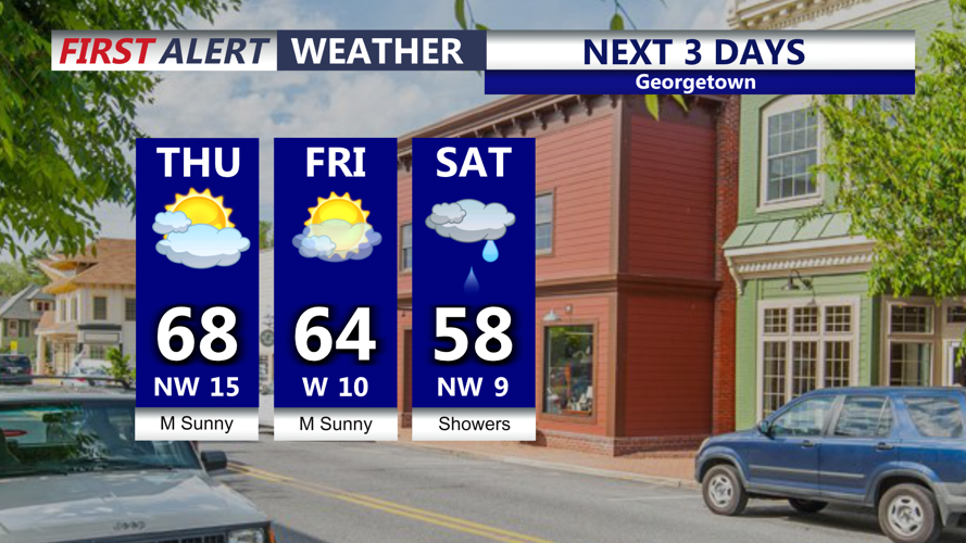
Showers will come to an end overnight, with skies turning partly cloudy as temperatures fall into the upper 40s to low 50s.

Next 3 Days

Sunny dry weather Thursday and Friday, shower chances return Saturday.

Sunshine returns behind the front on Thursday, though it will be breezy at times. Afternoon highs will reach the mid to upper 60s across Delmarva. Sunny skies continue Friday, with highs generally in the mid 60s.

Attention then turns to the weekend, when a storm system tracking near the region from the south could bring rain to Delmarva on Saturday. Forecast guidance continues to vary on the exact placement and strength of the surface low. Some guidance shows a stronger and farther north system, which would bring a more widespread shield of rain across the area. Other guidance keeps the system weaker and farther south, which would limit rain chances.

Regardless of the exact storm track, any system that develops should be a quick mover. Temperatures will also remain chilly this weekend as a closed low lingers across southeastern Canada, with Saturday likely being the coolest day. The weekend forecast will continue to be monitored, especially if trends favor a stronger and farther north storm track that could bring more widespread rainfall to Delmarva.

 Temperatures turn warmer next week with highs in the mid 70s.

Meteorologist

Chris Mastrobuono is a South Philly native, but has come to join the CoastTV meteorology team. With over three years of experience delivering accurate, passionate and insightful weather analysis, he is eager to report on the coast. Previously, he spent over two years as a morning meteorologist at WEVV CBS/FOX in Evansville, Indiana. 

Recommended for you