


DELMARVA - Tonight, a cold front will move south across the region, leading to a shift in winds from southwest to westerly. Despite the front, temperatures will remain warm today, peaking in the upper 60s to low/mid 70s along the coast. Offshore winds will prevent sea breezes from cooling the area significantly.
As the front continues southward this evening, winds will turn to an east/northeast direction, bringing cooler air and likely introducing marine stratus along the coast by Friday morning. Expect overnight lows to settle into the low to mid-50s.
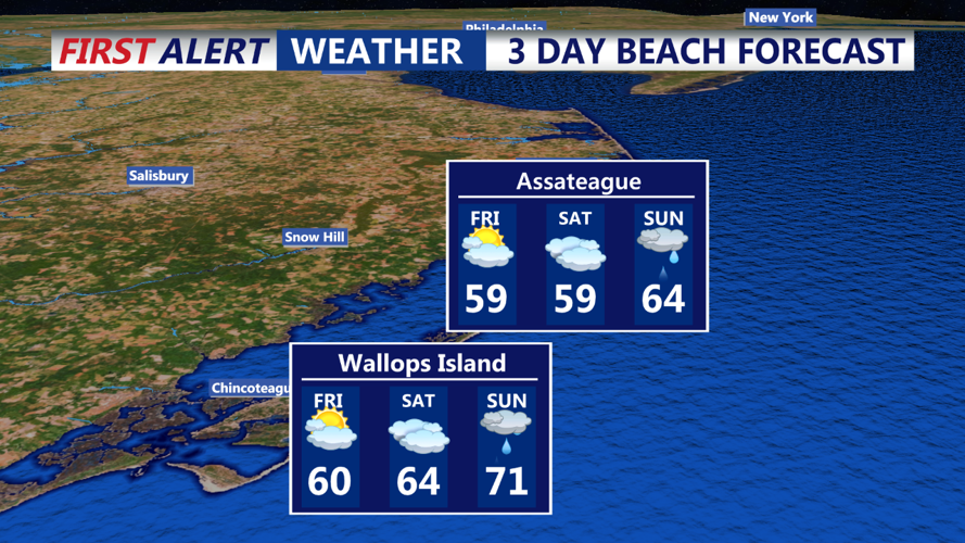
Friday will see the front stalling just south of the area, which will keep temperatures cooler, especially near the coast where highs will only reach the upper 50s to low 60s. Morning marine stratus is expected to push inland but will begin to retreat by the afternoon, allowing for some sunshine.
