


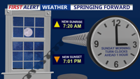


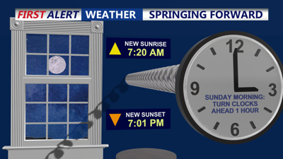
DELMARVA -- It will be a cold Saturday night on the peninsula as gusty winds subside and skies remain clear. With a dry air mass in place, temperatures are expected to plummet into the 20s by Sunday morning. As a reminder, Daylight Saving Time begins at 2 a.m. Sunday, so be sure to set clocks ahead one hour and check smoke detectors.
Sunday will bring mostly sunny skies with highs reaching the mid-to-upper 50s inland and lower 50s along the coast. Winds will remain breezy, with gusts between 25 and 30 mph.

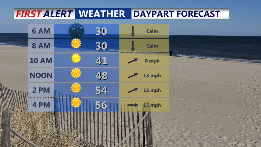
Wall-to-wall sunshine with highs in the mid 50s.
A weak low-pressure system passing north of the region will help push a stronger warm front through Sunday night, keeping overnight temperatures in the low to mid-30s.
Monday marks the start of a noticeable warm-up. Mostly sunny skies and a shift in winds will allow temperatures to climb into the upper 50s and low 60s across most of the region. Monday night will remain mild, with lows in the mid-to-upper 30s.
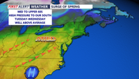
By Tuesday, a southwest flow will bring even warmer conditions, pushing afternoon highs into the 60s. A backdoor cold front moving in Tuesday night into Wednesday will briefly temper the warmth, but temperatures will remain in the mid-to-upper 60s midweek.

Highs surge into the mid to upper 60s, low 70s by late week.
Looking ahead, a southerly flow will persist into Friday and Saturday, continuing the warm stretch. Highs on Friday will range from the upper 50s to mid-60s, while a stronger push of warm air Saturday could bring temperatures into the mid-60s to low 70s.