


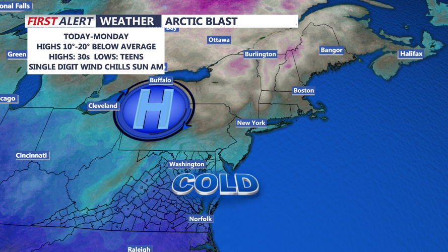


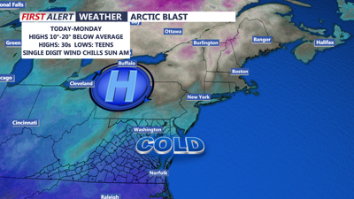
DELMARVA -- Today will mark the arrival of a strong and cold Canadian high-pressure system, bringing a blast of frigid air and gusty winds to the region. The winter solstice arrived early this morning and it will certainly feel like winter throughout the weekend. Winds out of the northwest will range from 15-20 mph, with gusts up to 30 mph.

Forecast Wind Chills Saturday Afternoon
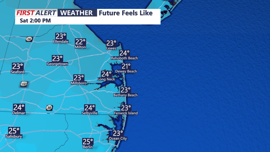
Combined with afternoon highs in the mid to upper 30s, wind chills will hover in the 20s for much of the day. Tonight will fall into the teens under starry skies.
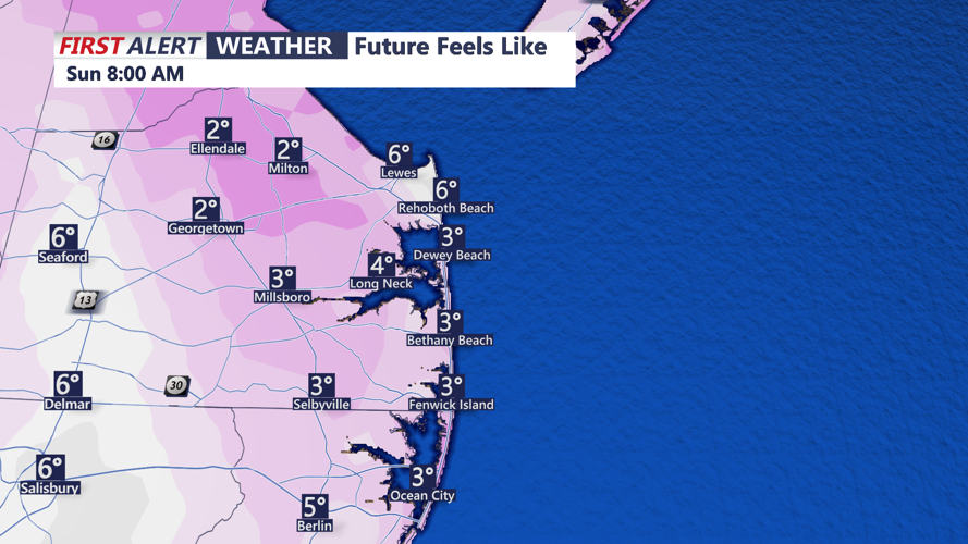
The bitter cold continues into Sunday, with morning wind chills plunging into the single digits. Daytime highs will struggle to reach the upper 20s to near 30, though winds are expected to calm as the high pressure settles overhead by Sunday afternoon.

Single digit wind chills Sunday morning
Overnight Sunday into Monday morning, temperatures could plummet into the low to mid-teens, thanks to clear skies and radiational cooling.
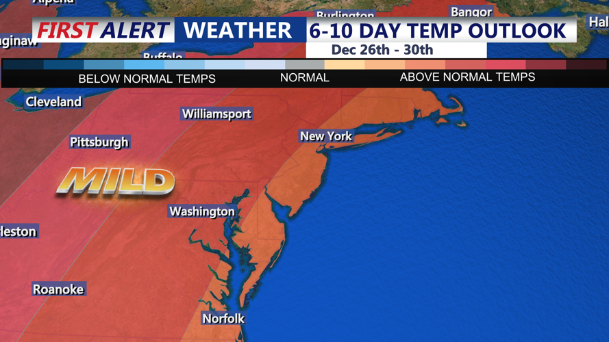
Looking ahead, a weak low-pressure system may impact the region Monday night into Christmas Eve, bringing light precipitation and the possibility of wintry weather, especially for northern Delaware. Temperatures are expected to rebound slightly, reaching the low to mid 40s on Tuesday. Christmas Day is trending dry, partly to mostly cloudy skies and highs in the mid 40s. In fact we will likely see a shift to some above average temperatures late week heading into New Year's Eve.

Above average temperatures late next week-New Year's Eve.
