



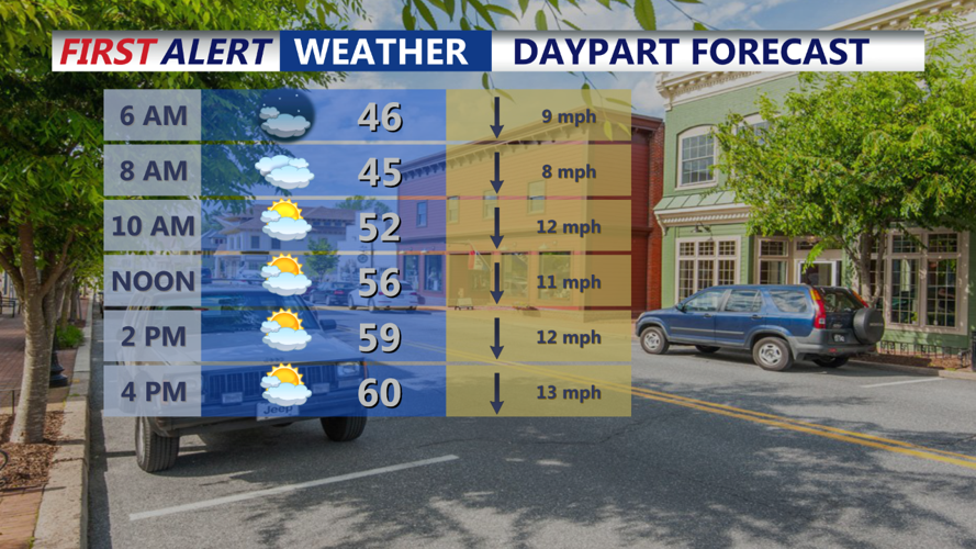

DELMARVA - Expect partly to mostly cloudy skies along the coast, with clearer skies inland across Delmarva as a coastal low lingers offshore. Temperatures will start off in the mid-40s, with north winds around 10-15 mph helping to keep the morning cool and breezy. The dry air in place should prevent any significant precipitation, although an isolated light shower near the coast cannot be ruled out.
Thursday Mid-Morning:
Cloud cover will persist along the Delaware and southern New Jersey coasts, but any potential showers will struggle against the dry air mass. Inland areas should see more sunshine breaking through, allowing temperatures to gradually rise into the mid-50s. Winds will continue from the north at 10-15 mph, maintaining a brisk feel to the air.
Thursday Afternoon:
Conditions will remain dry across most of Delmarva, with highs peaking around 60°F. Coastal areas may see clouds linger longer, while inland regions experience mostly sunny skies. North winds will stay steady around 10-15 mph, reinforcing the cool and breezy weather. Despite slight chances for light showers along the immediate coast, measurable rain is unlikely to reach Delmarva.
Thursday Evening:
As the coastal low slowly drifts away to the northeast, skies will gradually clear from west to east. Temperatures will drop quickly after sunset, with evening readings falling into the upper 40s. Winds will begin to ease slightly, though a light breeze from the north will persist, maintaining a chilly feel through the night.
Early Friday Morning:
With the offshore low departing, high pressure will bring clearer skies across Delmarva. Inland areas could see temperatures fall into the upper 30s, raising the potential for patchy frost, particularly in sheltered locations. Along the coast and in urban areas, lows are expected to remain in the low 40s, with a light north breeze helping to limit widespread frost formation.
Outlook:
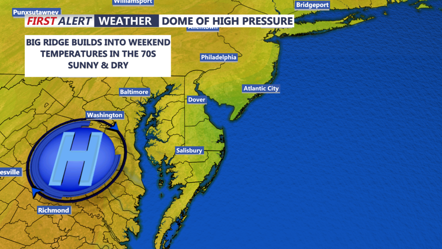
Friday will see rising temperatures under mostly sunny skies as high pressure strengthens, with highs reaching the mid to upper 60s. Clear and cool conditions will continue into Friday night, and the frost potential will need to be monitored for inland and rural areas as lows dip into the upper 30s once again. This cool, dry pattern is expected to hold through the weekend as high pressure remains in control.
