






DELMARVA - Temperatures this morning will drop into the 40s across most of Sussex County. Some inland communities, including Georgetown, Seaford, Laurel and Bridgeville, could see readings fall into the upper 30s this morning. Locations closer to the Atlantic Ocean and Delaware Bay, including Lewes, Rehoboth Beach, Bethany Beach and Fenwick Island, should remain slightly milder, with lows generally in the lower to middle 40s.
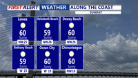
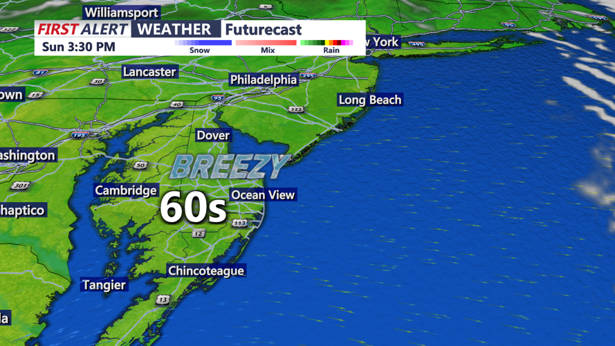
Sunday morning will begin with mostly clear to partly cloudy skies and a chilly start across southern Delaware. However, lighter winds and increasing sunshine will make conditions more comfortable as temperatures gradually rise after sunrise. By Sunday afternoon, temperatures are expected to climb into the lower 60s across much of Sussex County, a few degrees warmer than Saturday.
Winds will be noticeably lighter as high pressure gains greater influence over the region. Mostly sunny to partly cloudy skies are expected, providing favorable conditions for outdoor activities, shopping and visits to the Delaware beaches.
Winds should gradually ease Sunday as the pressure difference across the region weakens, although some lingering rough seas may continue over the open Atlantic waters. By Sunday afternoon, improving conditions will provide a more comfortable end to the weekend, with sunshine, lighter winds and temperatures returning to the lower 60s.
Looking ahead, generally dry weather is expected to continue through the early and middle portions of next week. Temperatures should remain seasonably cool, with afternoon highs mainly in the upper 50s to lower 60s and overnight lows ranging from the upper 30s to 40s.
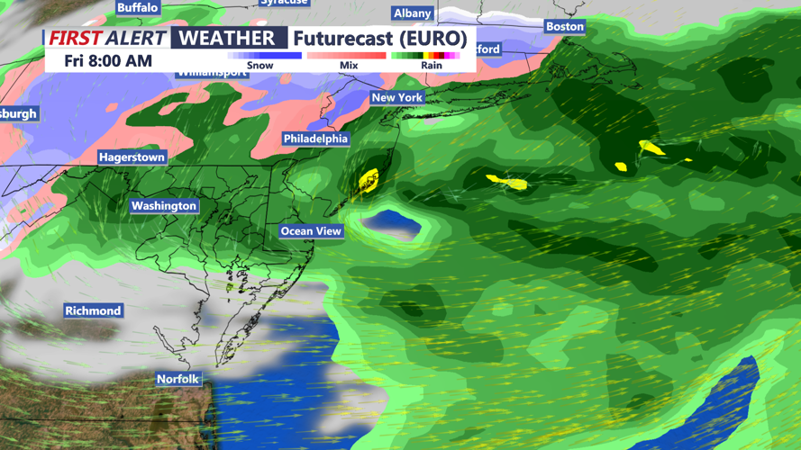
By Thursday and Friday, a coastal low will develop off our coast increasing rain chances later Thursday into Friday, along with much colder conditions. Wet snow is likely west of I-95, and into the higher terrain.
