


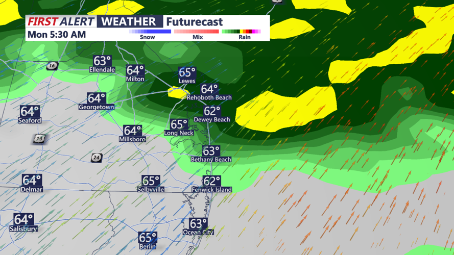


DELMARVA - Monday morning will begin with a few lingering showers near the coast as the first cold front exits the region. By late morning, skies will clear, giving way to a mostly sunny and breezy afternoon across Delmarva. Winds will remain gusty out of the northwest, with gusts up to 25 mph, but daytime highs will still be mild, ranging from the mid-60s to low-70s. Cooler and drier air will gradually filter into the region Monday night as the first front fully departs.
Late Monday night into early Tuesday morning, a secondary and stronger cold front will sweep through Delmarva. This front, while bringing no precipitation, will deliver a noticeable drop in temperatures. Overnight lows will dip into the upper 20s to low 30s inland, with mid-30s expected closer to the immediate coastline. Gusty north winds behind the front will reinforce the colder air, setting up a chilly Tuesday.
Tuesday will feature dry conditions under mostly sunny skies, but high temperatures will be significantly cooler, ranging from the mid-40s to near 60. Gusty winds will persist throughout the day, contributing to a heightened risk of fire spread due to the combination of dry air and breezy conditions. By Tuesday night, as high pressure builds into the region, north winds will help maintain the cold air, with overnight lows again falling into the upper 20s to mid-30s.
Stay tuned for updates as we monitor these sharp temperature changes and breezy conditions to kick off the week!
