



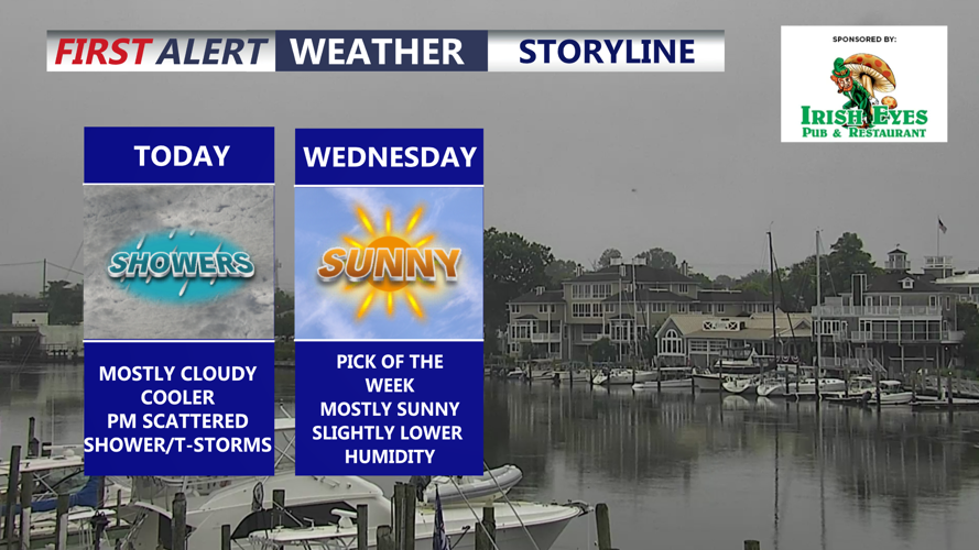

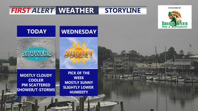
DELMARVA -- A cooler, cloudier pattern will hold across Delmarva today as a stationary front lingers just south of the peninsula, keeping the region under a northeast breeze and a marine-influenced air mass.

Mostly cloudy skies, possible shower through the early evening. Northeast winds 5 to 15 mph.
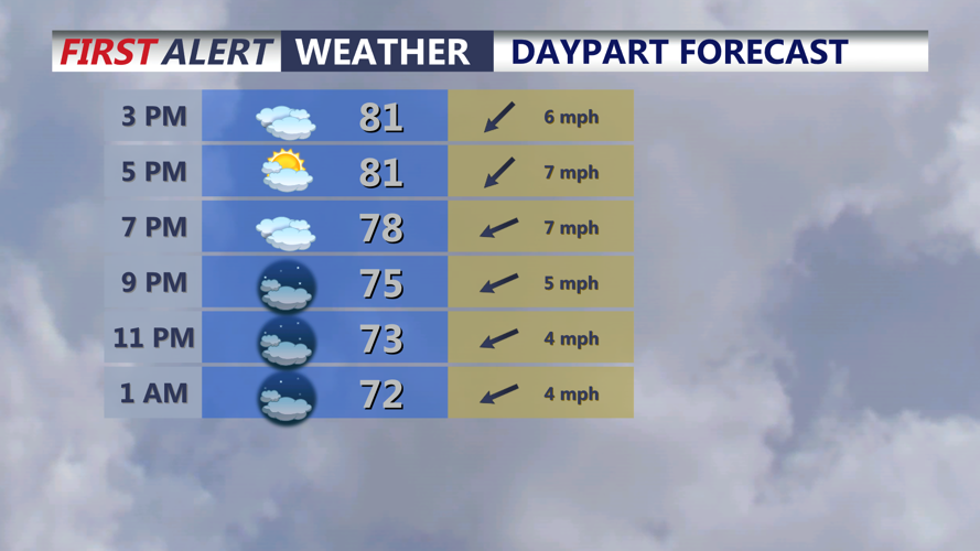
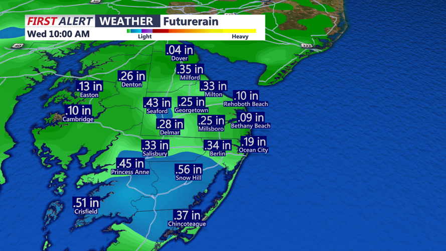
Mostly cloudy skies are expected through the day, with highs mainly in the upper 70s to low and mid-80s. Northeast winds will run 5 to 15 mph. A few scattered showers and thunderstorms remain possible, especially across the Maryland and Virginia Eastern Shores, with rain chances generally ranging from 20% to 50%. Another quarter to a half an inch of rain possible through tonight.

Another half an inch of rain is possible across the southern portion of the peninsula through this evening.
Tonight will stay mostly cloudy with a stray shower or thunderstorm possible. Lows will settle into the upper 60s to low 70s.

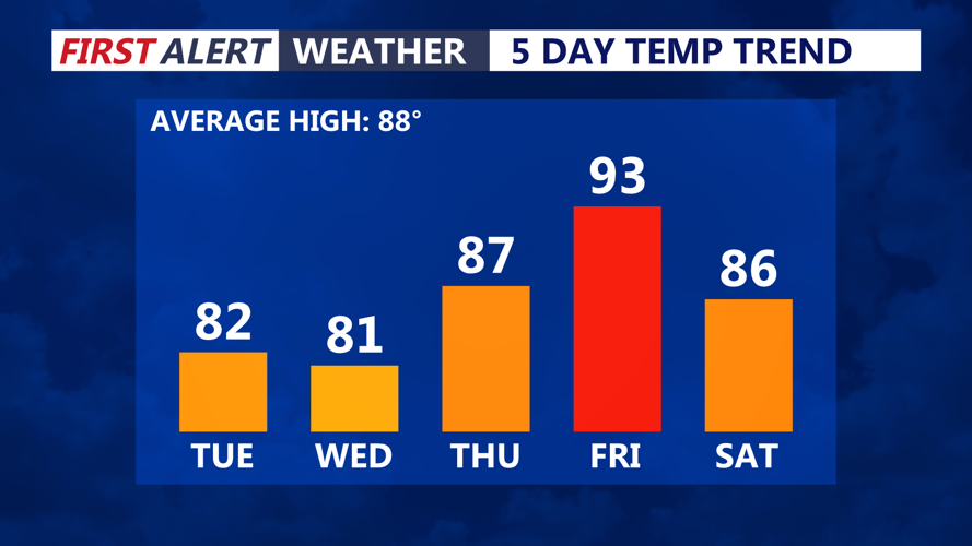
Temperatures cooler through Wednesday, brief uptick to the 90s Friday.
Wednesday looks like the pick of the week. Clouds will decrease through the morning, giving way to mostly sunny skies by afternoon. Temperatures will remain below average for July, with highs again in the upper 70s to low 80s.
The next chance for showers and thunderstorms arrives Thursday through Saturday as a cold front approaches and crosses Delmarva. Thursday will be warmer, with highs in the upper 80s and dew points climbing back toward the 70s. Friday looks to be the hottest day of the week, with highs in the low 90s.
While showers and storms are possible late week, this setup does not appear as extreme as the recent stretch of severe weather and flooding. The front should move through in a more progressive pattern, helping push the unsettled weather south before it stalls near or south of the region.
