


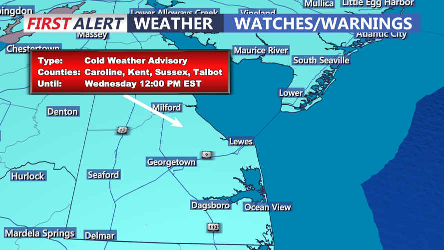
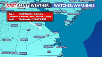


DELMARVA - Sussex County and Ocean City residents should brace for an exceptionally cold day Monday as an arctic air mass grips the region. Strengthening low pressure in the Canadian Maritimes and building high pressure to the west set the stage for a frigid forecast, marked by brisk winds and bitter wind chills.
Morning:
Skies will remain clear as strong cold air advection intensifies. Temperatures will start in the low teens across Sussex County and Ocean City, with wind chills dipping into the single digits. If you’re heading out early, layer up and limit exposure to the cold.
Afternoon:
Highs will struggle to climb above the mid-20s, making it one of the coldest afternoons of the season. Winds will gust between 10-15 mph, keeping wind chill values in the single digits to low teens. Outdoor activities should be minimized, and pets should be kept indoors.
Evening:
As high pressure moves closer to the region, winds will gradually diminish, but temperatures will plummet into the single digits by nightfall. Wind chills will fall below zero, making it dangerously cold. The Cold Weather Advisory remains in effect, urging residents to take precautions to stay warm and safe.
The forecast underscores the need for preparation and vigilance during extreme cold events. Wear multiple layers, cover exposed skin, and ensure your home is adequately heated. If possible, check on neighbors and loved ones who may need assistance.