


DELMARVA --Gradual clearing is on the horizon across Delmarva as the coastal low responsible for some showers shifts further offshore. Temperatures will rise to the middle and upper 50s during the day, with overnight lows dropping into the mid-to-upper 30s as high pressure begins to build into the region.
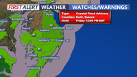
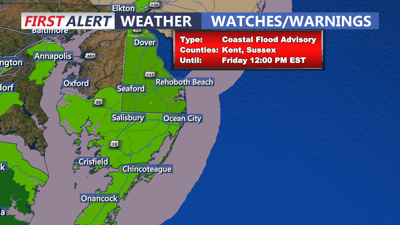
However, coastal flooding remains a concern due to persistent shore-parallel winds combined with increased astronomical tides from Friday’s full moon. A Coastal Flood Advisory is in effect through Friday morning’s high tide for the Atlantic-facing shores of Delaware and southern New Jersey. Minor tidal flooding is expected to continue into the weekend, so residents in vulnerable areas should remain vigilant and prepared for potential water encroachment.
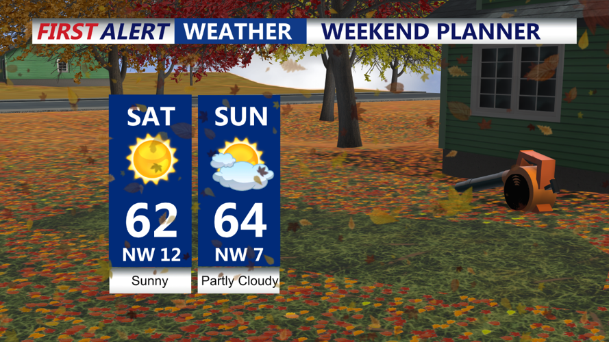
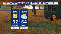
The weekend kicks off with sunshine on Saturday as an upper-level ridge of high pressure moves in. Highs will climb into the low-to-mid 60s, marking the start of a stretch of above-normal temperatures. However, the day will be breezy, with gusts of 20-30 mph (potentially reaching 40 mph in elevated areas) due to the pressure gradient between the incoming high and offshore low-pressure systems.

Saturday features mostly sunny skies and a fire concern
The dry air and gusty conditions will elevate fire weather concerns, so residents should avoid any outdoor burning activities.
Saturday night will feature clear skies and calmer winds as the high pressure moves closer. This will create favorable conditions for radiational cooling, bringing lows near freezing for most inland areas. Coastal and urban zones, however, may stay a bit warmer, with lows in the upper 30s to low 40s.
Sunday will remain mild, with highs in the low-to-mid 60s under mostly sunny skies. Overnight lows will stay in the upper 30s to low 40s.
As a cold front approaches on Monday, temperatures could briefly rise into the upper 60s ahead of its arrival. The front is expected to be moisture-starved, no rain is expected. Once the front passes, high pressure will rebuild, keeping temperatures in the 60s through midweek.
While the middle to late portion of next week may bring some unsettled weather, confidence remains low in the exact details. Early indications suggest the potential for rain as a more amplified weather pattern develops.