



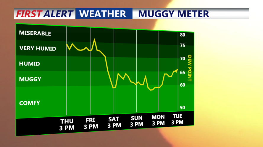

DELMARVA - Thursday will begin warm and muggy as a frontal boundary lifts north of the region, allowing hotter and more humid air to return.
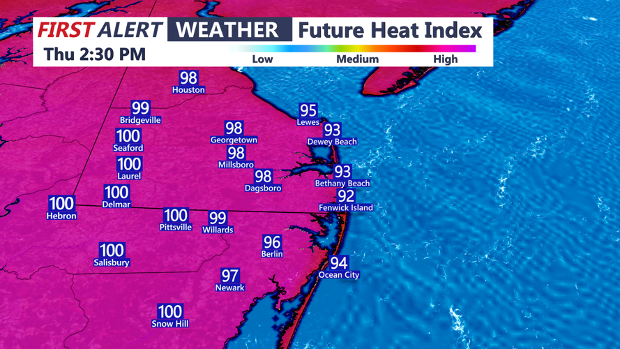
Temperatures will climb quickly through the morning, with afternoon highs reaching the upper 80s to lower 90s. Dew points in the low to mid-70s will make it feel considerably hotter, with heat index values potentially approaching 105 degrees in parts of Delmarva.
A Heat Advisory is in effect for the area because of the combination of high temperatures and oppressive humidity. Anyone spending extended time outdoors should take precautions against heat-related illness, especially during the afternoon.
Attention will then turn to another round of thunderstorms developing Thursday afternoon and evening.
The atmospheric setup could support damaging wind gusts, large hail and isolated tornadoes. Not every location will see severe weather, but any stronger storm will be capable of producing dangerous conditions.
Heavy rainfall will also be possible. While the overall flash flooding threat is lower than in some recent storm systems, repeated thunderstorms moving across the same locations could produce localized flooding.
Showers and thunderstorms may continue into Thursday night before gradually becoming more scattered toward early Friday morning. Warm and humid conditions will persist overnight, with lows generally in the 70s.
Additional thunderstorms will remain possible Friday, particularly across southern Delaware and the Maryland Eastern Shore, before drier and less humid weather arrives for the Labor Day weekend.
