


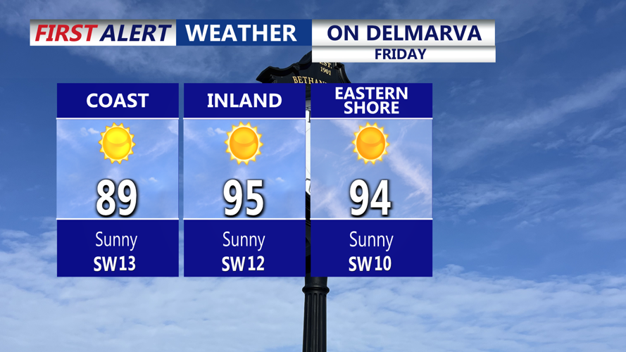


DELMARVA -- Sweltering start to the weekend Friday as high pressure offshore combines with an upper-level ridge, pulling in a hot and humid airmass.

Temperatures on Delmarva will range from 88 to 94 at the coast to 93 to 97 inland.
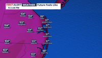
Afternoon temperatures will climb into the mid to upper 90s, and dew points in the low 70s will push heat index values between 103 and 108 degrees. The National Weather Service has issued a Heat Advisory for the region.

Feeling like 103 to 108 Friday afternoon.
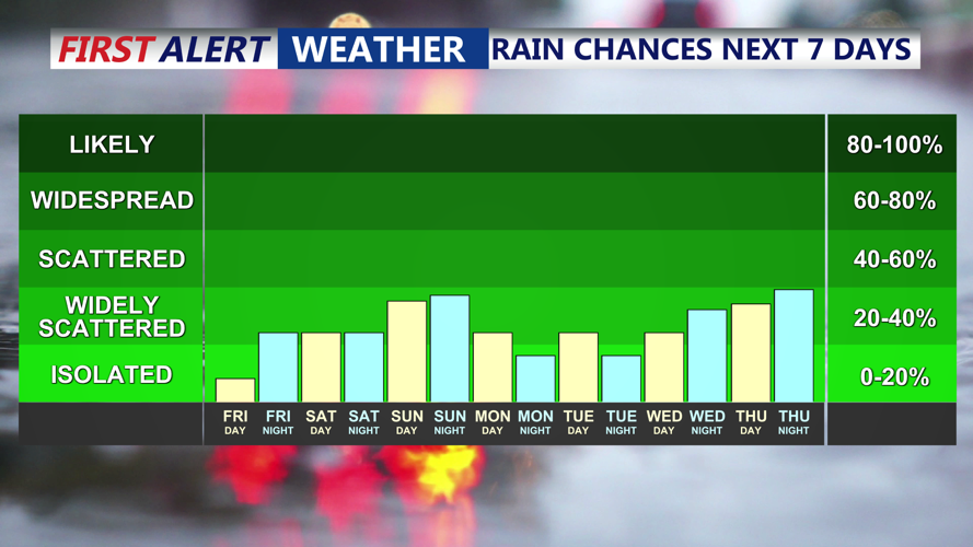
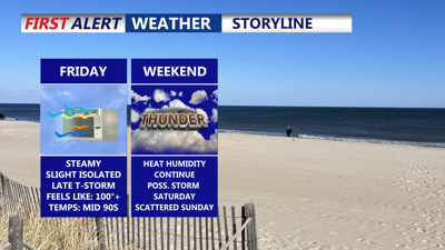
A cold front approaching late Friday afternoon and evening will spark isolated to scattered showers and thunderstorms, primarily moving northwest to southeast. Severe storms are more likely northwest of the I-95 corridor, but northern Sussex County and points north may see isolated activity. Any storm threat will weaken Friday night as temperatures drop into the low to mid-70s with clearing skies.

Isolated t-storm Friday evening, better chance for scattered storms Sunday.
The front will stall near the region Saturday, creating a more complex and unsettled weather pattern for the weekend. Saturday and Sunday will feature scattered showers and storms, the weekend will not be a complete washout. A stronger cold front late Sunday into Sunday night will bring an additional round of showers and storms before high pressure returns Monday, delivering a brief period of dry and mostly sunny weather.
Temperatures through the weekend will be seasonably warm, ranging from the upper 80s to low 90s, with dew points in the upper 60s to low 70s and heat indices between 90 and 100 degrees—below additional heat headline criteria. Overnight lows will remain mild, in the mid-70s.
Looking ahead, heat and humidity will rebuild by midweek, supporting another round of showers and storms Wednesday as yet another cold front approaches. With heat indices potentially exceeding 100 degrees again, additional heat headlines may be issued next week.


