


DELMARVA -- A prolonged and potentially dangerous stretch of hot weather beginning Sunday night, as a dome of high pressure builds westward from the Atlantic into the Mid-Atlantic region.
Cloud cover on Sunday, carried in from a decaying thunderstorm complex to the north, initially tempered daytime highs across the peninsula. But as the system dissipated, it spread high clouds across the area.

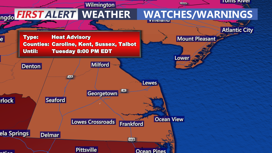
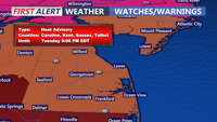
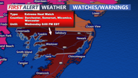
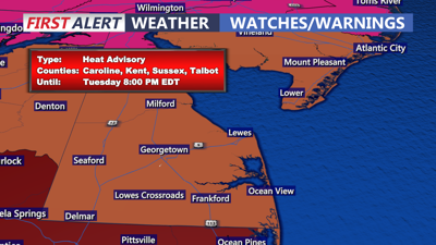
Extreme Heat Watch up for Dorchester, Somerset, Wicomico, Worcester and Accomack counties.
Sunday night, skies are expected to remain partly cloudy with low temperatures ranging from the mid to upper 70s. This marks the start of a pattern that will intensify through midweek.

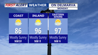
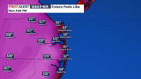
Sweltering Monday, with hazy, hot and humidity conditions highs could hit near 99 in some inland locations.
By Monday, the ridge of high pressure will settle over the region, elevating temperatures and suppressing any chance of rain. Highs are forecast to near the triple-digit mark, with heat index values between 100 and 110 degrees. While coastal areas may benefit from a slight onshore breeze, interior parts of Delmarva will likely experience the brunt of the oppressive conditions.

Heat indices Monday 103 to 107
Extreme Heat Warnings and Heat Advisories remain in effect for much of the peninsula. Even nighttime will offer little reprieve, with lows remaining in the upper 70s to near 80 degrees through Tuesday night. You will want to limit outdoor activity during peak afternoon hours, stay hydrated, and check on vulnerable populations.

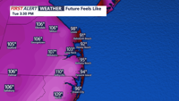
Heat indices Tuesday between 105 to 110.
The heat is expected to peak on Tuesday, with temperatures potentially exceeding 100 degrees in some locations. Although humidity may mix down slightly in the afternoon, the cumulative heat effects remain a concern.
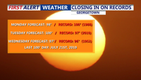
Record high temperatures are likely to be broken both Tuesday and Wednesday, record high on Tuesday is 97 degrees back in 2010, Wednesday record is 96 degrees set back in 1952. We may even break some overnight low temperatures. Record low for Tuesday is 74 set in 2010 and Wednesday the record low is 75 set in 2019.

Think we beat the record high temperatures both Tuesday and Wednesday, we may also break some overnight low temperatures.
By Wednesday, the ridge will begin to retreat, allowing temperatures to ease slightly—though highs will still climb into the mid to upper 90s. Heat indices will remain near 100 degrees, and advisories may need to be extended to account for prolonged exposure risks.
Toward the end of the week, a weakening ridge and approaching surface trough will increase the likelihood of afternoon showers and thunderstorms, some of which could be severe. Temperatures will trend closer to seasonal norms, ranging from the upper 80s to low 90s on Thursday, and possibly dipping into the 80s by Friday and the weekend.
Unsettled weather looks likely through the weekend, bringing some relief from the heat but also the potential for localized downpours and strong storms.