


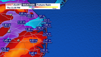


Sussex County is bracing for a potentially significant flash flood threat beginning late Thursday as a slow-moving cold front approaches the region.
Widespread showers and heavy thunderstorms developing Thursday evening and continuing into the night. Rainfall totals could reach one to three inches in most areas, with some locations seeing up to five to seven inches. Rainfall rates exceeding two inches per hour are possible, which could quickly overwhelm drainage systems.
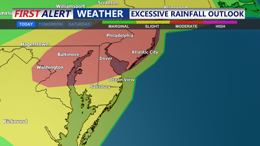
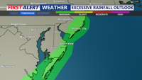
A Moderate Risk (level 3 of 4) of flash flooding has been issued, with a Flood Watch in effect from 2 p.m. Thursday through 6 a.m. Friday. Officials urge residents to avoid driving through flooded roads and to have reliable ways to receive weather alerts.
Alongside the flooding potential, isolated to scattered severe thunderstorms could bring locally damaging wind gusts before the front fully moves through. Temperatures Thursday will remain warm and humid, with highs in the upper 80s to low 90s and heat indices in the 90s.
By Friday, cooler and breezier conditions will settle into Sussex County as the front slides south and a weak coastal low forms offshore. Expect cloudy skies, occasional showers or drizzle, and sustained northeast winds between 10 and 20 mph, with gusts near 30 mph inland and up to 40 mph along the coast. Temperatures will fall to the low and mid-70s, with some cooler inland areas staying in the upper 60s throughout the day.
Conditions are forecast to improve by the weekend as high pressure builds in, bringing pleasant and dry weather.