


DELMARVA - High pressure will prevail through tonight across Delmarva, with a frontal boundary stalled south of the area. A weak system will pass by Saturday night, then high pressure will remain offshore through much of next week, bringing daily chances for showers and thunderstorms.
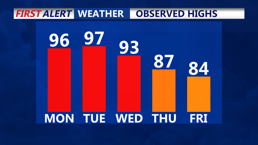
Near Term (Through Saturday): Our nice day of summer continues this Friday with warm temperatures and very low humidity. Dew points around the region are comfortably in the upper 50s. A dry and cool night is in store for us as well, with lows dropping into the 60s again.
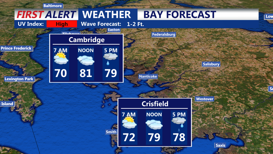
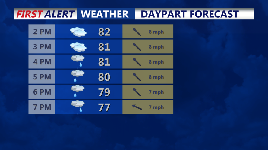
The stalled frontal boundary to our south will begin to return northward on Saturday as a shortwave trough nears the region. As it does, high clouds will increase across Delmarva through the day. Chances for some showers and possibly an isolated thunderstorm will come mid to late afternoon, with the greatest chances (25-40%) across Delmarva and southern New Jersey. Portions of eastern Pennsylvania could see a 20-30% chance for a shower or thunderstorm as well. Otherwise, most of the region will remain dry and seasonable. Afternoon highs will remain in the low to mid 80s, with dew points creeping back into the low to mid 60s.
Short Term (Saturday Night Through Sunday Night): The stalled frontal boundary to our south will begin to return northward into the area by Saturday night as a shortwave trough nears the region. The trough and associated jet streak will pass through Saturday night, with zonal flow returning by Sunday.