


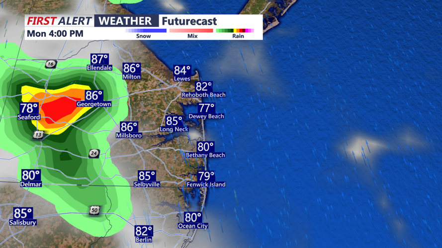


DELMARVA -- Expect partly sunny skies into the afternoon hours, allowing temperatures to climb into the mid to upper 80s. As the day progresses, a cold front advancing from the west will bring increasing humidity and instability.

By late this afternoon through the evening, expect isolated to scattered showers and thunderstorms to develop across the region. Downpours could be locally heavy, and while the risk for severe weather is low, any stronger storms may produce gusty winds, flash flooding and frequent lightning. Be weather aware later today and this evening.

After sunset, a few spotty showers and pockets of heavier rain will linger. Fog formation will be likely overnight, as temperatures dip into the low to mid 70s, keeping the air uncomfortably humid.

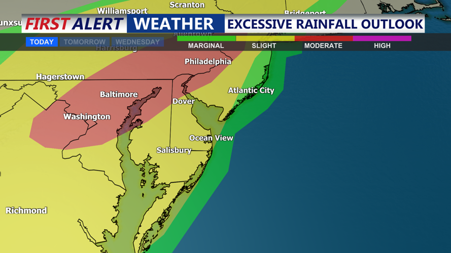
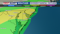
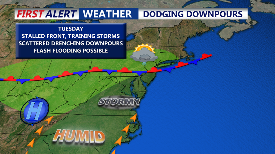
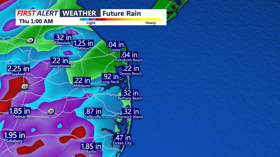
The cold front will stall over Delmarva Tuesday through midweek, maintaining a daily chance for scattered showers and thunderstorms. With abundant moisture lingering in the atmosphere, any storm could unleash locally heavy downpours, leading to ponding on roads and reduced visibility. Can't rule out the possibility of flash flooding with slow moving training storms.

A mid- and upper-level ridge building in from the southwest may gradually reduce the coverage of storms, but forecast confidence remains low on exactly when this drier trend could take hold. Rainfall amounts over the next few days could exceed 3 inches in some places.

Afternoon highs both days will stay in the mid to upper 80s, with muggy nights in the 70s. Fog is possible again late at night and near sunrise, especially in areas that see heavier rainfall.
Looking beyond midweek, the focus shifts to intensifying heat and humidity. Warm air advection from the southwest will send heat index values toward 100 degrees by Thursday, creating potentially dangerous conditions for outdoor activities. Depending on the timing of the next cold front, this oppressive heat may linger into Friday.
By the end of the week, the next front is forecast to approach the region. This boundary could serve as a trigger for more widespread showers and thunderstorms, although the timing and strength remain uncertain. While severe storms are not strongly signaled, any front arriving during peak heating could marginally increase the risk for damaging winds.
