



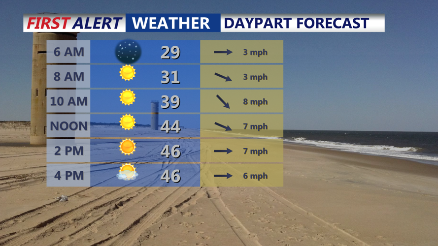

DELMARVA -- Despite an active winter marked by at least two rounds of snowfall, Delmarva remains in a drought that has persisted since last fall. However, improvements are gradually emerging. Tonight, the region will stay dry with lows dipping into the upper 20s to low 30s.
Sunday promises sensational weather for Delmarva. With predominantly sunny skies and seasonable temperatures, most areas can expect highs in the upper 40s. High pressure will continue to hold sway through the weekend and into early next week, ensuring a pleasant day ahead.

Expect mostly sunny skies and seasonable temperatures Sunday.
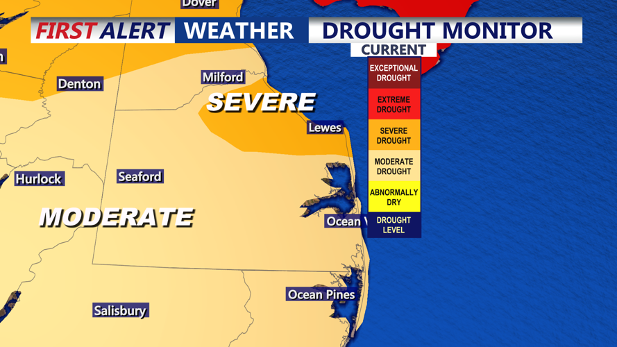
Even though winter has brought multiple snowfall events to the peninsula, the region is still chipping away at a significant moisture deficit. After spending months in an extreme to severe drought we see some improvements. The latest drought monitor indicates that most of Delmarva is in moderate drought, while portions of northeastern Sussex County remain in severe drought.

Drought conditions slowly approving on Delmarva.
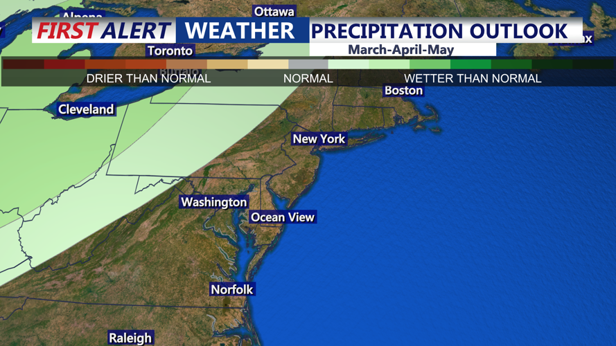
Factors like runoff, soil moisture, and an overall active weather pattern mean that no single storm will end the drought. Over the next month, gradual improvements are expected, and the Climate Prediction Center shows equal chances for above or below average precipitation over the next three months.

Equal chances for above or below average precipitation.
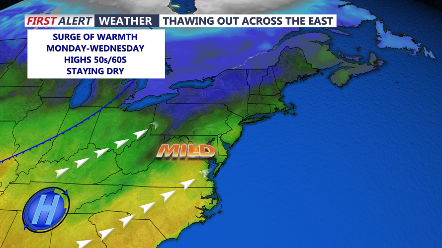
Sunday night, high pressure will be centered just to the south before slipping east off the coast on Monday. This shift will usher in southerly winds and an increasing warming trend with no significant chance of precipitation. Although a passing shortwave may cloud some sunshine, Monday’s daytime highs will rebound into the 50s after a chilly night in the 20s.
Tuesday is expected to bring even milder conditions, with most areas seeing highs ranging from the upper 50s to some low 60s. As high pressure begins to weaken with an upper trough moving toward the upper Great Lakes, a low pressure system develops over the Ohio Valley.

Highs surging into the 50s & 60s next week.
This system will track east-northeast across the Middle Atlantic region on Thursday, bringing chance of precipitation. Rain is most likely for most locals, though the northern and northwestern areas may see a few snow chances. Temperatures on Wednesday and Thursday will run above normal, but as the stronger cold front arrives later on Thursday, conditions will shift closer to normal for Friday, with typical highs in the upper 40s and lows around 30 for the Delaware Valley during late February.
Once the front passes on Friday, a brief cool-down ensues as a Canadian air mass pushes into the area, although not dramatically so. The remainder of Friday should see fair weather, with conditions improving as we move into the early part of next weekend.
