


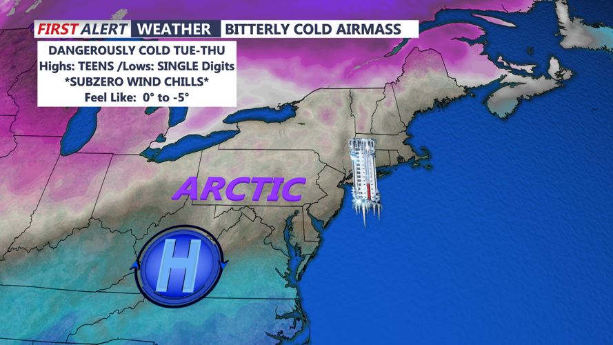


DELMARVA -- Today will see a brief but low-impact winter weather event as a storm system moves northward, with rain transitioning to sleet and snow later in the day. While precipitation amounts will be light, with most areas seeing an inch or less, the real story will be the frigid air mass arriving in the storm’s wake.
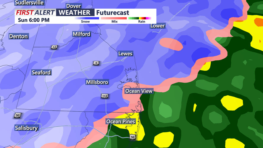
Rain is expected to develop this afternoon before quickly changing to sleet and then snow by the evening as colder air sweeps into the region.

Brief period of snow is expected late this afternoon - evening
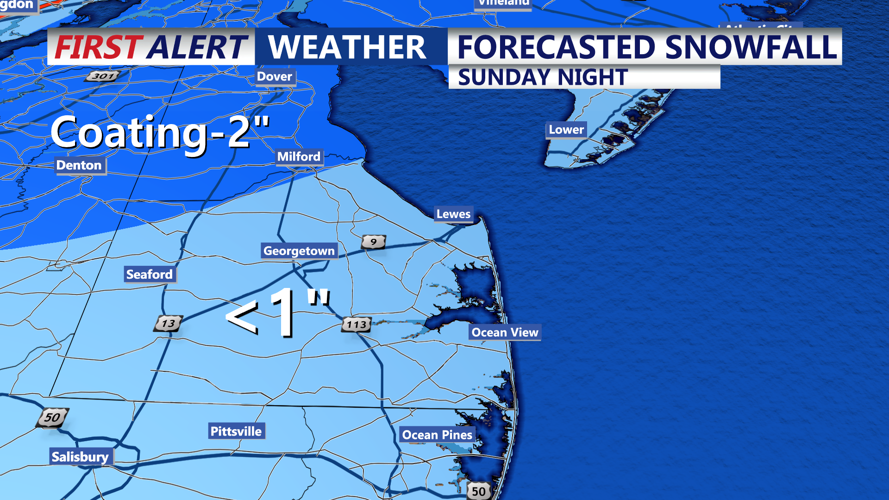
While Sussex County and the coastal areas should see minimal snow accumulation, areas further north and west may experience slightly higher totals. Precipitation is expected to taper off by Sunday night.

Forecasted Snowfall Through Tonight
Behind the departing storm, temperatures will plummet as Canadian high pressure takes control. Clearing skies Sunday night into Monday morning, combined with a fresh snowpack, will lead to lows in the single digits across much of the area. Wind chills will drop into the single digits or below zero, creating dangerously cold conditions for people, animals, and infrastructure.

Wind chill values 0 to -5
Monday will bring mostly clear skies but little relief from the cold. Highs will struggle to rise above the teens and 20s, with wind chills remaining in the single digits.
The most intense cold is expected Monday night, with lows plunging into the single digits and wind chills as low as minus five. These conditions heighten the risk of frostbite, hypothermia, and damage to unprotected pipes.
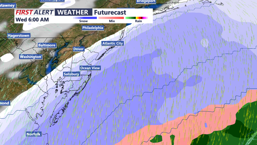
The arctic air mass will dominate through midweek, with Tuesday forecasted to be the coldest day. There is a slight chance of additional snow Tuesday night into Wednesday, though model uncertainty remains high, with heavier snowfall likely staying offshore.

Snow Threat Tuesday Night-Wednesday Morning
By Thursday, temperatures will begin a gradual climb, providing some relief from the bitter cold. Another low-pressure system could potentially impact the region late in the week, but confidence in its development and track is low.