



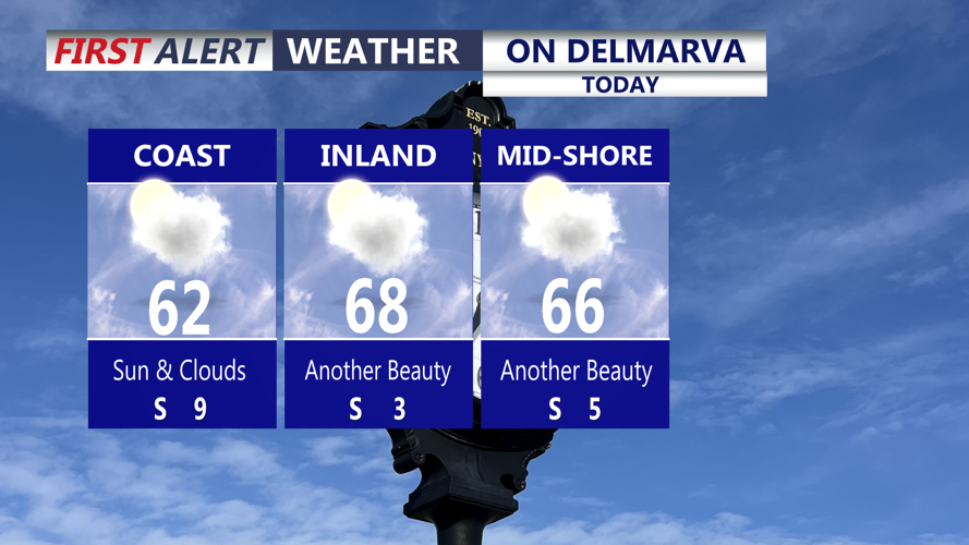

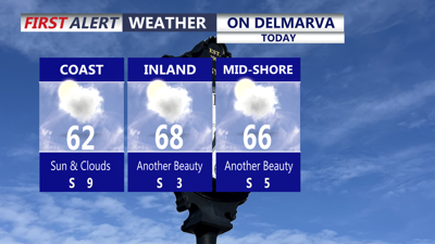
DELMARVA -- We have hit 16 straight days without measurable rainfall in Georgetown and will take on at least two more days to that. A mix of sun and clouds today with highs in the low to mid 60s. High pressure remains in control through midweek. Winds will be very light out of the south.

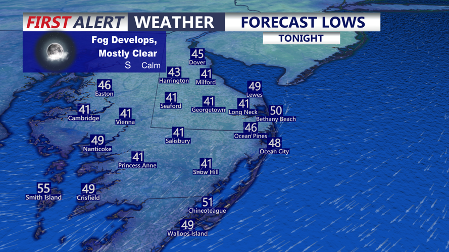
Areas of fog will develop into Tuesday morning, temperatures falling into the low 40s inland, upper 40s to near 50 at the coast.
Expecting dew points to slowly rise tonight and with calm winds and clear skies there will be areas of fog that develop into Tuesday morning.

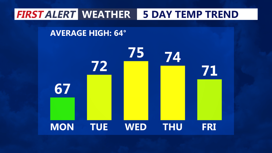
Temperatures will be above normal through the first week of November.
A warming trend will be with us this week, expecting most of the week to be above normal high (63 degrees). Following some morning fog will have mostly sunny skies and highs in the low 70s. Will have another chance for fog Tuesday night into Wednesday morning as the warming trend will continue.

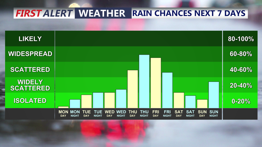
Next rain chances will arrive Thursday and linger into Friday.
Wednesday highs will be in the mid 70s under partly cloudy skies. Staying dry through the day as our next chance of rain doesn't arrive until Thursday. An area of low pressure and cold front will bring the chance for showers Thursday afternoon and lasting into Friday. An area of low pressure may try to develop along the front Friday keeping unsettled conditions around. Early estimated rainfall look to be on the order of 0.35 to 0.75 inches of rainfall into Friday.
The rain looks to clear out heading into the weekend as cooler drier air filter into the region. Highs Saturday in the upper 60s under mostly sunny skies and Sunday highs back into the low 60s under partly cloudy skies. Another system could bring some showers to the region Monday as average to slightly below average temperatures will be with us into the second week of the month.
