


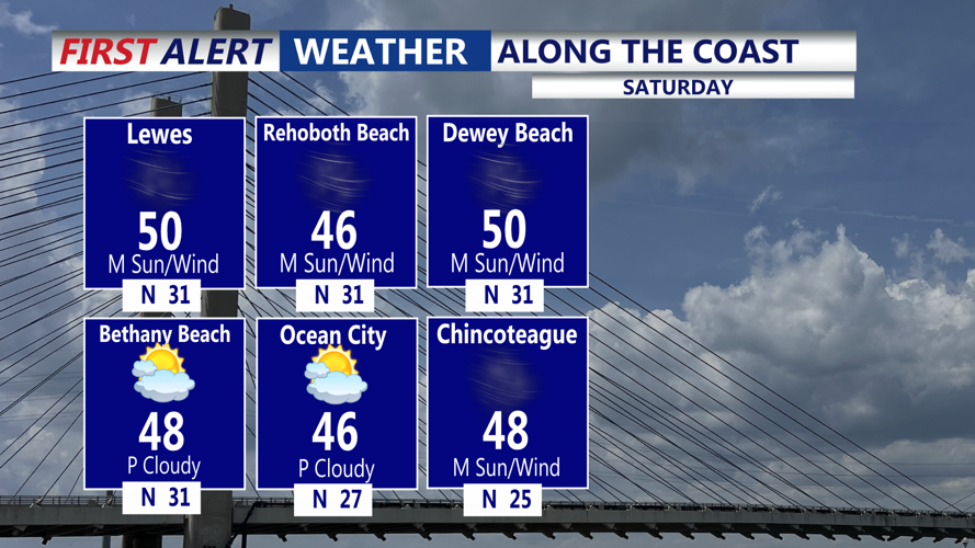
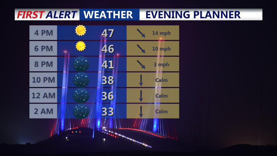

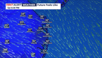


DELMARVA - The rest of Saturday will be bright, but blustery across Delmarva, with wall-to-wall sunshine doing little to offset the chilly air. Highs will reach the mid to upper 40s, though it will feel more like the 30s during the afternoon because of strong northwest winds gusting from 25 to 30 mph.
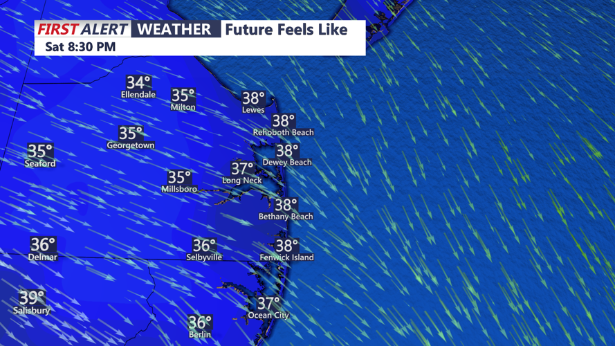
By Saturday night, high pressure moves overhead, setting us up for a chilly night and Sunday morning. Protect your plants from freezing temperatures Sunday morning. As high pressure shifts to our east, a return flow will develop and warmer air will start to move back into the region. Highs on Sunday will climb into the mid 50s, which is close to normal for late March.
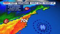
The bigger story arrives next week as high pressure becomes established off the Mid-Atlantic coast and an upper-level ridge builds along the Eastern Seaboard. This pattern is expected to bring an unusually warm airmass into Delmarva, sending highs into the 60s and 70s on Monday and into the upper 70s from Tuesday through the rest of the week. Some locations could even approach 80 degrees, especially by Wednesday.
There is still one factor to watch this time of year. With high pressure moving through southern Canada, a back door cold front remains a possibility, and that could allow much cooler air to slip into the region and keep those unusually warm temperatures from fully developing.
Along with the warmth, several disturbances are expected to move through beginning Wednesday. That will bring daily chances for showers and possibly a few thunderstorms through the end of next week.
