



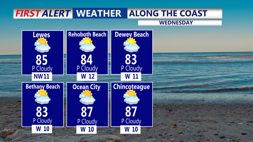
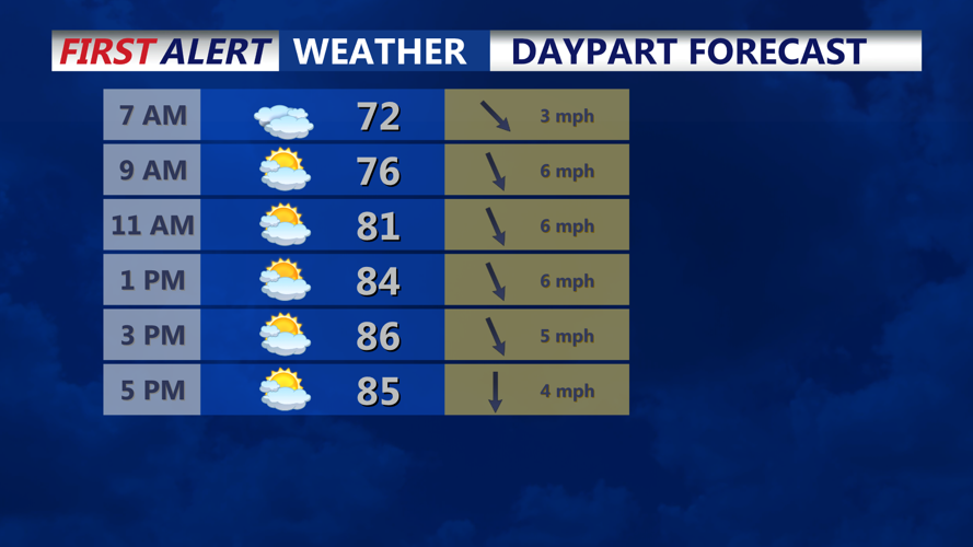

DELMARVA - Showers and thunderstorms could move across Delmarva early Wednesday morning, followed by additional storms later in the day and Wednesday night as an unsettled weather pattern continues across Delmarva.
Temperatures are in the 70s to start, most of the shower and thunderstorm activity from overnight convection to our west has weakened. Expect some clouds and a brief shower or sprinkle possible through 8AM.
Otherwise a seasonable pleasant day on tap for Delmarva, mix of sun and clouds and highs in the upper 80s. Not overly oppressive with the humidity as heat indices will be in the low to mid 90s.
Isolated showers and thunderstorms could develop Wednesday afternoon and evening as disturbances move along a nearly stationary frontal boundary mainly to our north. A few stronger storms could produce damaging wind gusts, frequent lightning and locally heavy rain. But the greatest likelihood of that would be to our north across Pennsylvania.
Another concern will be along the coast and Delaware Bay during the Wednesday evening high tide. Astronomical tides associated with the new moon, combined with elevated water levels, could result in minor tidal flooding in vulnerable coastal and bayside communities.
Scattered showers and thunderstorms could continue into Wednesday night and early Thursday morning before the frontal boundary begins making more progress through the region later Thursday.
