


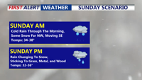


DELMARVA - Rain changes to snow later today with light accumulations, then bitterly cold air follows into early next week.
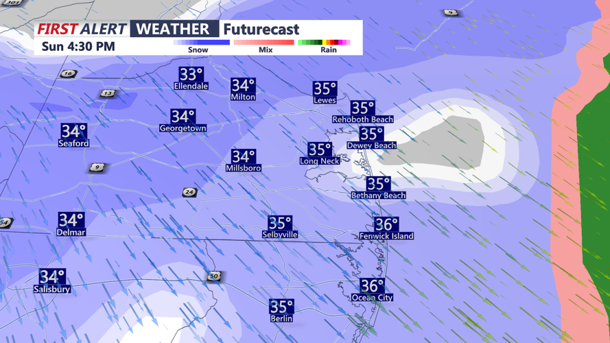
A cold rain continues the rest of this morning, then gradually transitioning to snow from northwest to southeast early in the afternoon. Then all snow mid-afternoon into the evening hours as temperatures fall into the lower 30s late in the afternoon. Snow will stick to grassy surfaces, wood, and metal objects. Roads will be wet, then possibly slushy as the snow continues into the evening hours. The snow then winds down early in the evening. Watch for slick roads as temperatures slip below the freezing mark.
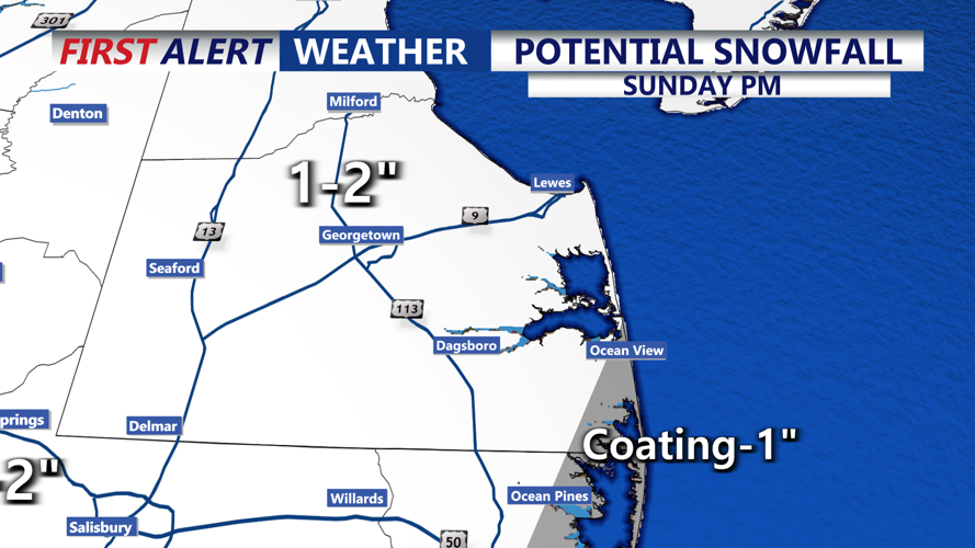
In Sussex county, a light accumulation is expected, with around one to two inches expected, with slightly lower totals at the beaches. Rain could hold down accumulation amounts in some areas.
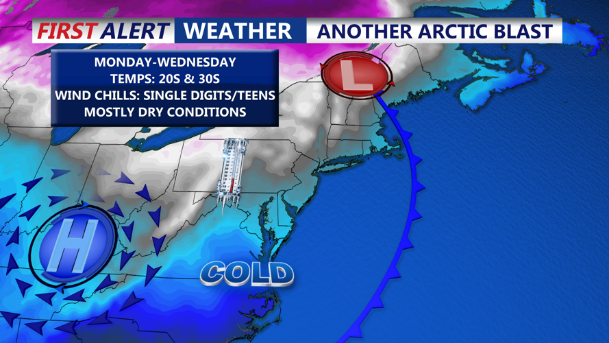
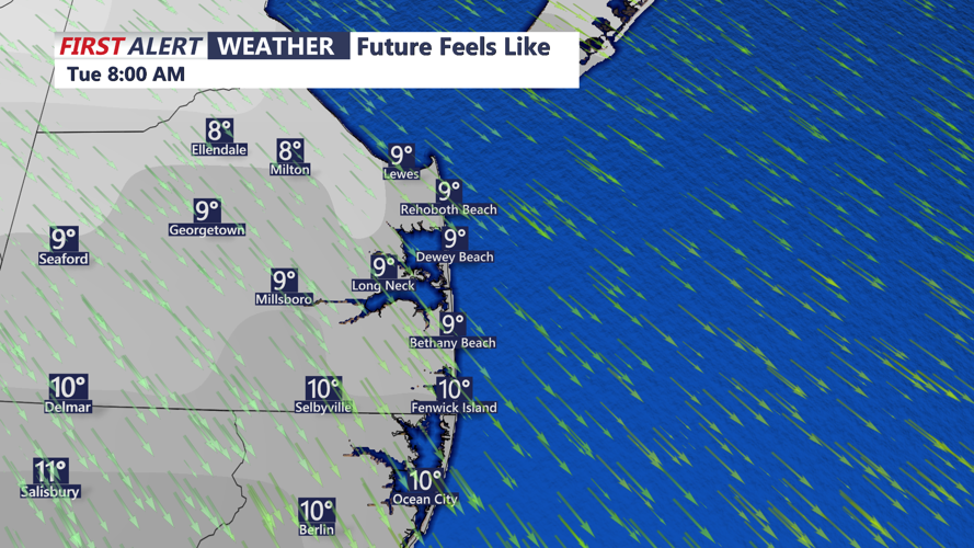
Behind that system, a deep eastern U.S. trough ushers in an arctic airmass. Dry weather is expected, but several days of below-normal temperatures set in from Sunday into the middle of next week. The coldest stretch looks to be Monday night through Tuesday night, when wind chills could drop into the single digits. Tuesday currently appears to be the coldest day, with highs projected in the mid to upper 20s. Some moderation in temperatures is expected for the mid to later part of next week.