


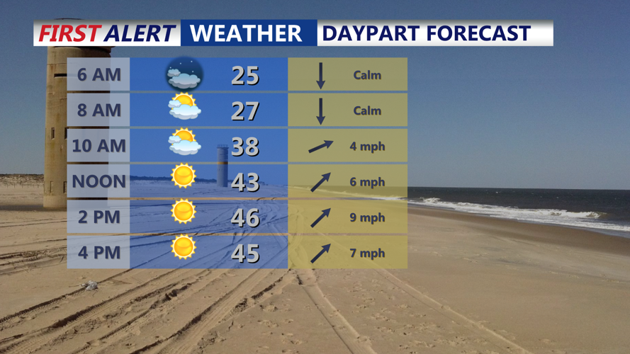

DELMARVA -- A pleasant start to the week as high pressure shifts offshore, bringing moderating temperatures and mostly dry conditions. Today, expect mostly sunny skies with highs in the mid to upper 40s and breezy southwest winds at 15-25 mph. Tonight, temperatures will dip into the upper 20s to low 30s under partly cloudy skies.
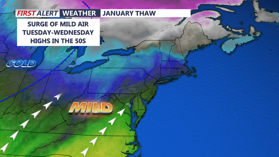
Tuesday will see highs reaching the upper 40s to low 50s across the peninsula under partly cloudy skies. By Wednesday, temperatures will climb into the mid-50s ahead of a strong cold front. This system is expected to pass through Wednesday night, ushering in a return to colder air as arctic high pressure builds in from the north.
Thursday will feel noticeably colder, with highs in the mid to upper 30s and overnight lows ranging from the teens to mid-20s. While dry conditions are expected during most of the week, a complex storm system rolls in next weekend that could bring in a round of rain and snow mix.
A closed upper low across the Southwest is projected to move northeastward into the Plains and Midwest later this week. While uncertainty remains regarding the exact trajectory, there is an increased probability of precipitation Saturday-Sunday, with chances around 40-50%. Depending on the system’s evolution, Delmarva could see some wintry precipitation, but details remain unclear at this time.
