


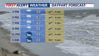
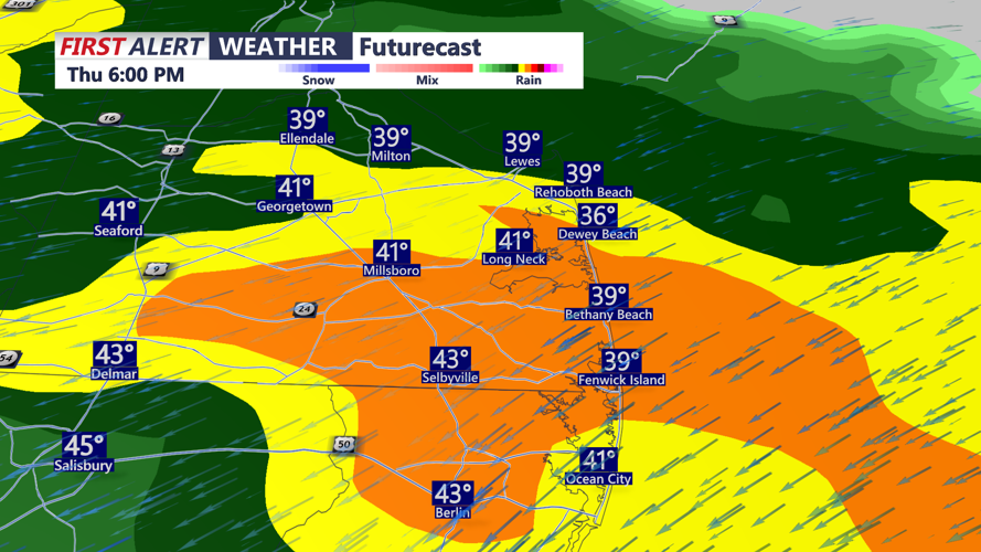


DELMARVA -- Today is shaping up to be more of a “keep the umbrella handy” kind of day across Delmarva. A steady onshore breeze off the Atlantic will hold temperatures down in the mid to upper 40s, and skies will stay locked in on the gray side. Rain develops later this afternoon and continues into the evening, and it could turn heavy at times as a warm front lifts north through the region.

On and off rain develops this afternoon, rain will be heavy at times.
Tonight, the warm front continues to work toward the peninsula as low pressure tracks into the western Great Lakes. Temperatures won’t drop much, hovering in the upper 30s to low to mid 40s, with a few lingering showers around and areas of patchy fog developing.
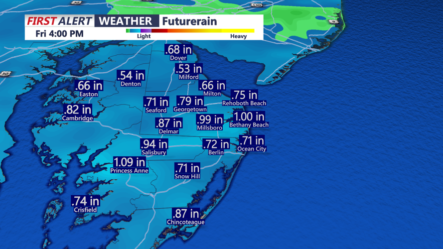
Friday brings another round of rain, especially during the morning hours. Expect a wet commute with the potential for downpours, and while widespread storms are not expected, a rumble of thunder can’t be ruled out. Rainfall totals will be 0.75 inches to a little over an inch by midday Friday.

Rainfall between this afternoon - midday Friday, some areas picking up over an inch.
The good news is improvement arrives later in the day. As we move into the afternoon, temperatures should rebound into the mid to upper 50s ahead of an approaching cold front, and conditions should gradually dry out. By Friday evening, it turns noticeably breezy with west-northwest wind gusts around 30 to 35 mph.
Looking at the weekend, Saturday is the pick: partly sunny skies and highs in the low 50s.
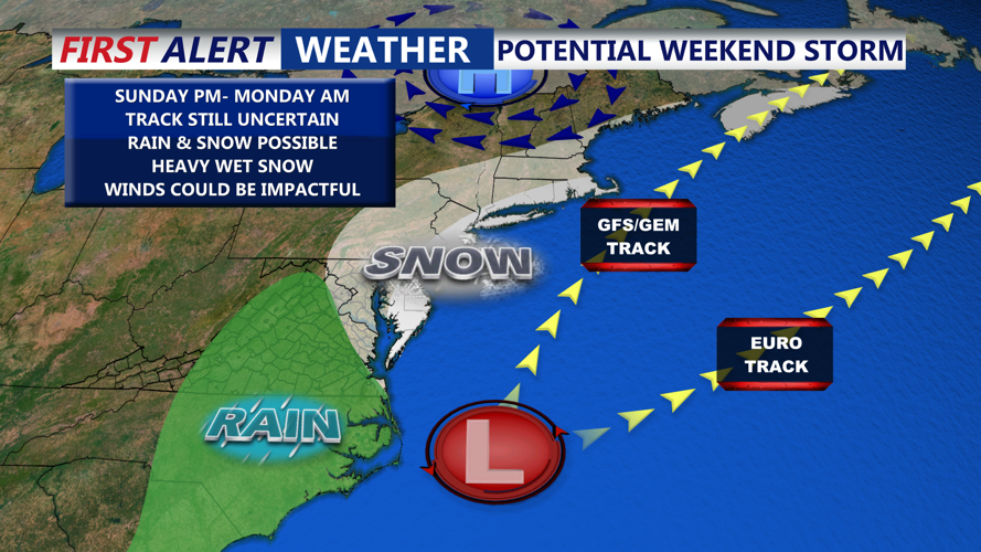
Then all eyes shift to Sunday night into Monday morning. There is still a large amount of uncertainty with this potential coastal storm setup. Some guidance suggests a stronger system that deepens rapidly just off the coast, which could mean a colder, high-impact scenario with rain changing to very heavy, wet snow in parts of Delmarva. Other guidance keeps the storm weaker and/or farther east, delaying intensification until it is already moving away, which would reduce impacts locally. At this point, model guidance generally supports low pressure moving off the Southeast or Mid-Atlantic coast Saturday night, deepening a few hundred miles offshore Sunday into early Monday, then pushing east and out to sea Monday—but the exact track and strength are still up in the air.

All eyes on the threat of snow late Sunday night-Monday morning, all about track and intensity of storm.
Behind that system, a colder air mass looks to settle in early next week. Monday and Tuesday currently trend much colder with highs in the mid 30s to near 40 degrees and lows dropping into the mid 20s.
