


DELMARVA - The showery and breezy conditions continue this evening with temperatures in the 50s. More of the same through the overnight hours, with occasional rain and drizzle, plus gusty winds at times. Temperatures remain steady in the mid 50s, then slowly rise late tonight into Sunday morning.
The beaches will continue to face dangerous conditions. A high risk of rip currents remains in place for the Delaware, Maryland, and Virginia coasts. Ocean water temperatures remain mainly in the 50s to low 60s, which can quickly lead to hypothermia or physical incapacitation for anyone suddenly immersed in the water. Beachgoers should avoid entering the surf and stay alert to posted warnings.
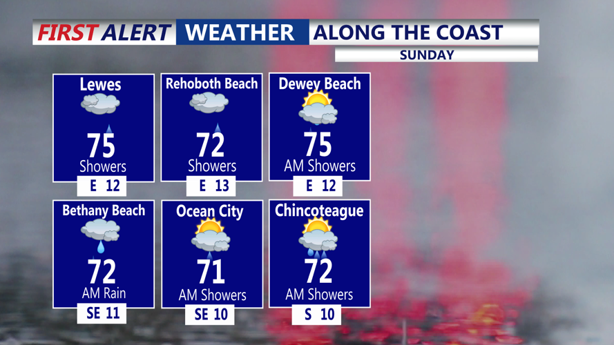
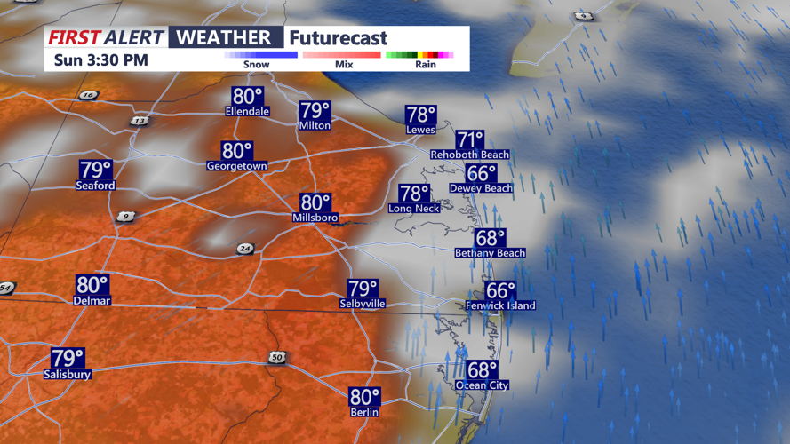
By Sunday, we'll see more of a showery regime, with breaks in the clouds at times. A few thunderstorms are possible as well. Temperatures recover slightly, but they will likely remain below average. Some drier conditions are possible by Sunday afternoon. Temperatures will warm into the mid 70s, with cooler 60s at the beaches. For Sunday night, the risk for showers continues, with lows in the low to mid 60s.
Memorial Day will be warmer, though not completely dry. The active pattern is expected to continue early next week, with a few showers still possible at times Monday, and possibly some rumbles of thunder. How warm it gets will depend on cloud cover and how widespread any showers become. There will be dry times for Memorial Day observances and cookouts.
