



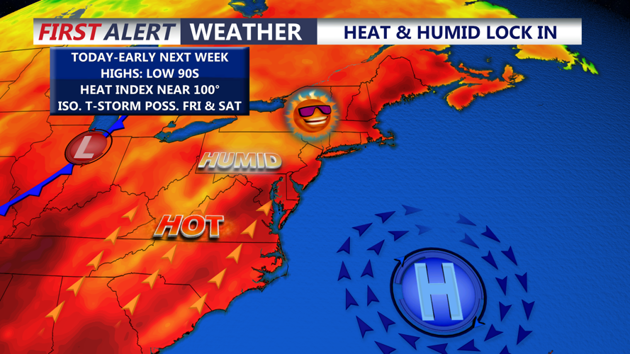

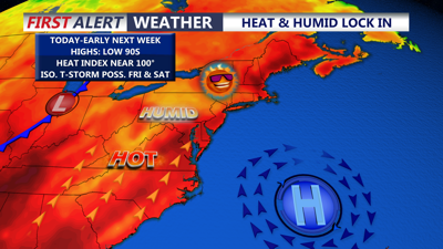
DELMARVA -- A stubborn summer weather pattern will keep Delmarva hot, humid and periodically stormy beginning Thursday and continuing through at least Tuesday.
High pressure centered near Bermuda will remain offshore while warm, moisture-rich air flows northward across the peninsula. With little movement in the larger weather pattern, the humidity will remain especially noticeable for several days. A stronger cold front may finally bring more meaningful relief late Tuesday or Wednesday.

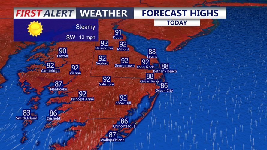
Steamy day on Delmarva, highs in the upper 80s to low 90s.
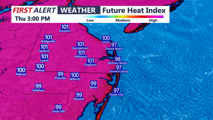
Highs today in the upper 80s to low 90s, it will feel like 96 to 102. Tonight mostly clear and muggy with lows in the mid to upper 70s.

The oppressive humidity will make it feel like 96 to 102 degrees.
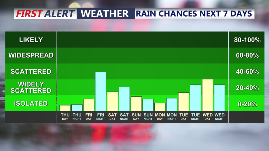
Friday will feature more hot and steamy conditions, sunny skies and highs in the low 90s. Heat index 97 to 102. Showers and thunderstorms are expected to become more widespread Friday as atmospheric conditions become more favorable for organized storms. But storms look to hold off until Friday evening.

Isolated t-storms will be possible Friday and Saturday evenings.
Saturday will feature more heat and humidity with partly cloudy skies and highs in the low 90s. The exact timing and coverage of Saturday’s storms remain uncertain. Current indications suggest thunderstorms may develop later in the day, during the evening or possibly overnight as a weak front approaches Delmarva.
A weak cold front is expected to cross the region by early Sunday, allowing slightly drier air to move across Delmarva.
Sunday should offer a temporary reduction in the oppressive humidity along with a lower chance of thunderstorms. It will not turn cool, however, with afternoon temperatures still expected to reach the upper 80s to lower 90s.
The break will be brief. Moisture will begin returning Monday, bringing another stretch of hot and very humid weather through Tuesday.
Thunderstorms will again be possible each day. Increasing winds higher in the atmosphere may allow storms early next week to become stronger and better organized than those seen this week. Damaging winds could become the primary concern, although localized heavy rainfall will remain possible.
Forecast confidence regarding the exact timing and placement of the strongest storms remains limited this far in advance.
A stronger cold front is expected to approach Delmarva late Tuesday or Wednesday. The front should help reduce the excessive heat and humidity, although scattered afternoon thunderstorms may remain possible even after it passes.
Residents should monitor updated forecasts throughout the period, especially before outdoor activities. Stay hydrated, limit strenuous work during the hottest parts of the day and never drive through a flooded roadway.
