


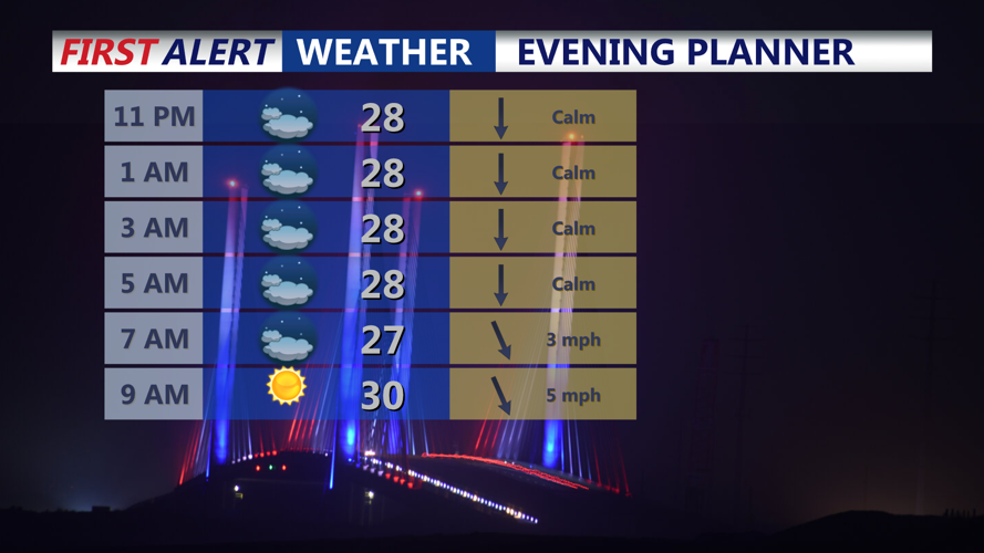

DELMARVA- The cold weather continues the rest of the weekend into early next week, then warming up next week.
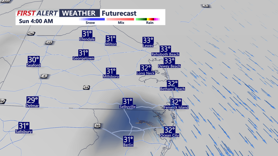
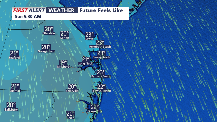
For the overnight hours into early Sunday, a low pressure system is forecast to track well south of Delmarva while another system moves to the north. Most forecast guidance keeps the bulk of precipitation south of the region, and it is likely that Delmarva sees no precipitation at all. However, there remains an outside chance of a few flurries. No accumulations are expected.
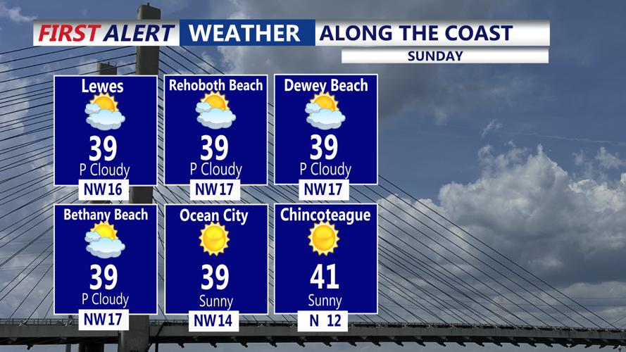
By Sunday, high pressure builds back in, allowing clouds to decrease through the day. It will remain cold, with highs in the mid to upper 30s, and a northwest breeze will add to the chill.
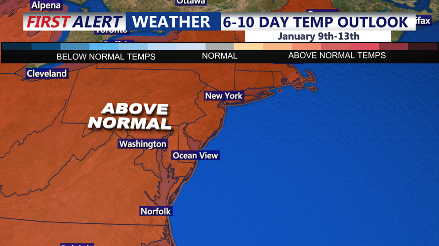
High pressure continues into Monday, keeping conditions dry but cold, with highs again in the 30s to around 40 degrees. The high shifts offshore by Tuesday, allowing temperatures to begin moderating into the 40s to near 50 degrees. A cold front is expected to cross Delmarva later Wednesday, with highs climbing into the low to mid 50s ahead of the front. High pressure returns Thursday, with slightly cooler air. Rain chances increase Friday, then into the weekend as low pressure is expected to track along a cold front. Some of the rain could possibly be heavy into the weekend. Temperatures remain in the 50s for late week into next weekend.
