


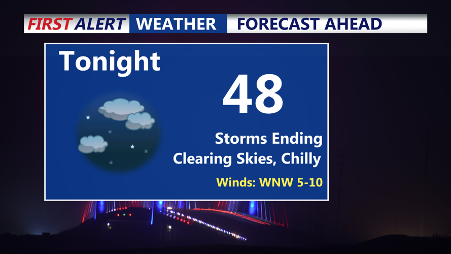


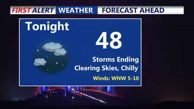
DELMARVA -- The end of a stormy day for Delmarva, following an active afternoon of severe weather. Multiple thunderstorms pushed through the region, with reports of damaging winds and pea to dime size hail across Sussex County. Fortunately, the severe threat has now come to an end. As a strong cold front continues to sweep through the region Saturday evening, skies will gradually clear overnight.
Temperatures will fall sharply behind the front, with overnight lows dipping into the 40s and low 50s—more typical of mid-April than early June. West to northwest winds will blow at 5 to 10 mph, adding a slight chill to the night air.
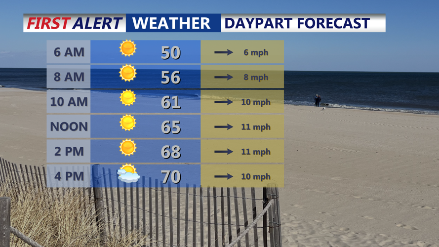
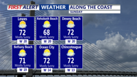
Sunday will offer a noticeable change in weather, featuring dry conditions and cooler-than-normal temperatures to start June. Highs across the region will climb into the upper 60s to low 70s. Although this is still below seasonal norms, a dry airmass and less gusty winds will make for a comfortable day. Winds from the west will range between 10 and 15 mph, with occasional gusts near 30 mph.

Look for mostly sunny breezy conditions Sunday with highs in the low 70s.

Mostly sunny skies at the beach, breezy at times with gusts to 30 mph out of the west.
High pressure will continue to build from the Ohio Valley into the mid-Atlantic late Sunday into Monday, promoting generally dry conditions. However, an upper-level trough may bring some afternoon clouds, especially on Monday.
Sunday night will once again bring chilly temperatures, with lows in the 40s in many areas and 50s in the warmer spots. By Monday night, lows will moderate slightly, mostly remaining in the 50s. Monday’s highs will rebound into the 70s across the area, even along the shore and in higher elevations.

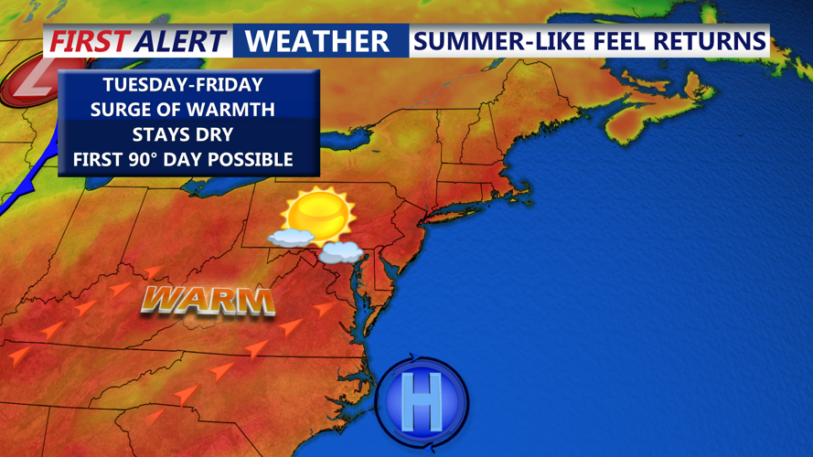
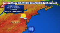
It will feel like summer next with as we make a run at our first 90 degree day of the year.
A shift in the weather pattern is expected through the middle and end of the week. A high-pressure system will move offshore and take a position similar to the Bermuda High, ushering in a warming trend. Highs are forecast to reach the low to mid-80s by Tuesday, upper 80s Wednesday, and possibly hit 90 degrees on Thursday—potentially the first 90-degree day of the season.
Nighttime temperatures will also rise, starting near 60 degrees Tuesday night, climbing into the mid-60s Wednesday night, and potentially remaining around 70 degrees Thursday night.
A cold front could approach by Friday, bringing a slight chance of showers and thunderstorms. However, most of the week is expected to remain dry with increasingly summer-like conditions.
