


DELMARVA - A slow-moving frontal boundary will continue to dominate the weather pattern across the Mid-Atlantic through late Thursday evening, keeping conditions unsettled and at times hazardous.
Through tonight, a Severe Thunderstorm Watch remains in effect until 9 p.m., with damaging wind gusts up to 70 mph possible as storms track eastward. A Flood Watch continues until 10 p.m. due to high moisture levels and the potential for localized flash flooding. Any lingering storms should taper off around midnight, but scattered showers may persist, especially near the coast. Overnight temperatures will stay warm, holding in the upper 60s to mid-70s under mostly cloudy skies.
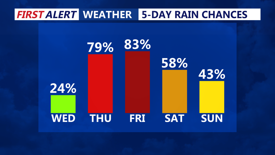
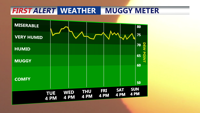
Wednesday is expected to bring more of the same. The frontal boundary will sag further south, slightly reducing the severe threat north of Philadelphia but maintaining a SLIGHT risk of severe storms and excessive rainfall across southern portions of the region. Showers and thunderstorms are likely to redevelop by mid to late afternoon. Humid air will keep heat index values in the 90s despite increased cloud cover, though heat advisories are not anticipated.
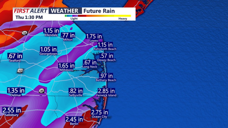
Wednesday night through Thursday, the warm and tropical airmass will remain in place, with lows in the lower 70s and highs in the mid-80s. Another round of thunderstorms is likely Thursday afternoon and evening as additional disturbances approach from the west. These storms could produce locally heavy rainfall and damaging wind gusts, continuing the threat for flash flooding.
Heading into Friday and the weekend, the Bermuda high will persist offshore, gradually breaking down early next week. A series of disturbances will cross the region, keeping daily chances for showers and thunderstorms mainly during the afternoon and evening hours.
Residents are urged to stay alert for weather updates and monitor any watches or warnings that may be issued over the next several days.
