


DELMARVA- High pressure has moved east of Delmarva, allowing warm and more humid air to move into the region. Summer temperatures will stick around into a part of the weekend with a few showers and storms possible.

For Thursday afternoon, expect breezy, warmer, and more humid conditions. Highs in the low to mid 80s are expected , with breezy south winds gusting up to 30 mph, especially at the coast.
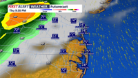
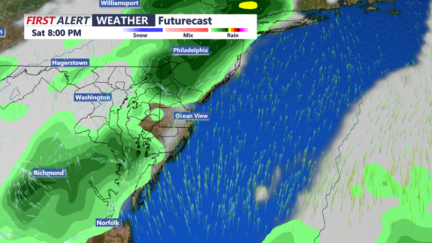
A change in the weather pattern arrives Thursday night through Friday, as a pair of cold fronts move towards Delmarva. At this point, it appears the fronts are starved for moisture, with little promise of a soaking rain. Any rainfall would be beneficial. A few showers and thunderstorms are possible later this evening, and then again on Saturday evening.

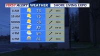
Temperatures on Friday and Saturday will be well into the 80s with a muggy feel to the air. If you're headed to the Shore Living Expo in Salisbury, dress for summer.

For the second half of the weekend, Canadian high pressure will build back into the region, ushering in cooler and drier air. Highs will return to the 70s, with overnight lows settling in the 50s into next week.
