


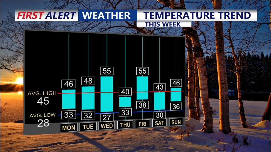


DELMARVA -- Mostly sunny skies today as high pressure takes control. Westerly winds will strengthen throughout the day, with occasional gusts reaching 15-25 mph. Despite the breezy conditions, temperatures will remain seasonable, with highs climbing to the mid to upper 40s.
Clear skies tonight will give way to increasing clouds as a cold front approaches from the west. Overnight lows will stay slightly warmer than last night, ranging from the upper 20s to low 30s, aided by modest southwesterly winds.

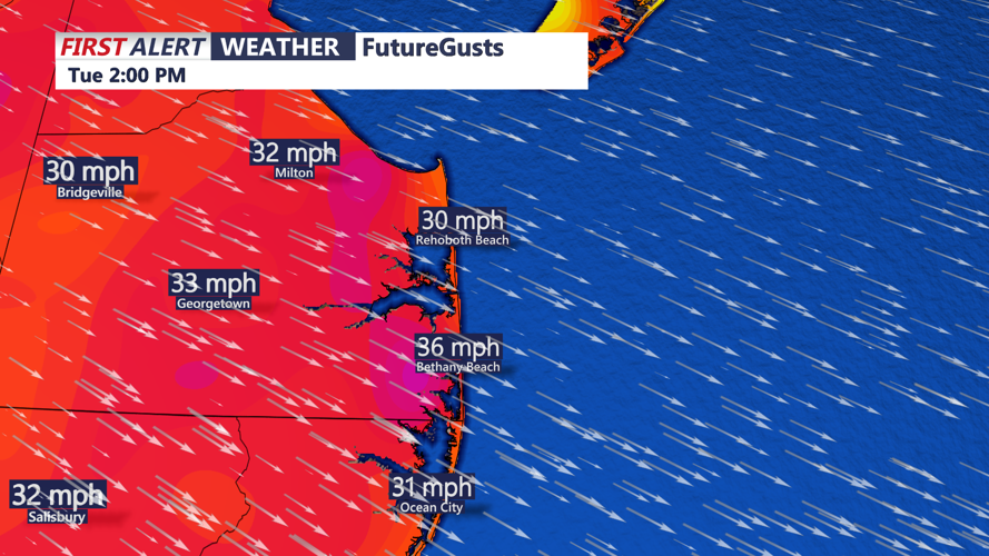
Gusts as high as 25-35 MPH Tuesday and Wednesday.
Tuesday brings partly cloudy skies and continued breezy conditions. Highs will remain in the mid to upper 40s, with wind gusts of 20-30 mph out of the west. By Wednesday, a mild day is expected, with highs reaching the mid-50s under partly cloudy skies and gusts again in the 20-30 mph range.

Cold front moves through late Wednesday-Thursday.
A cold front will move through the region Wednesday night into Thursday, ushering in a brief shot of colder air. Highs on Thursday will dip to the upper 30s to low 40s, accompanied by mostly sunny skies and dry conditions.

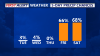
Dry week through Friday, then widespread precipitation is expected.
As the week progresses, attention turns to another low-pressure system expected to approach from the Southern Plains on Friday into Saturday. A warm front associated with this system could lift northward across the region, potentially stalling near the area. While the timing and track of this system remain uncertain, Delmarva could see widespread precipitation by Friday evening or Saturday. Forecast models suggest a mix of precipitation types could be possible, depending on the system’s eventual path and temperature profiles.
