


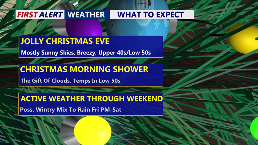


DELMARVA -- A weak area of high pressure is bringing a bright and breezy Christmas Eve to Delmarva, with sunshine, northwest winds and seasonable temperatures. Highs today are expected to reach the upper 40s to near 50, while overnight lows dip into the 20s and low 30s.

Mostly cloudy skies on Delmarva as Santa rolls into the region.
Conditions turn quieter tonight before a weak clipper system slides through the region on Christmas Day.

Brief morning shower Christmas Day, storm system could bring a brief wintry mix to rain late Friday night.
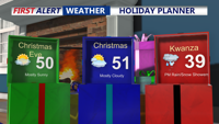
Skies will be mostly cloudy, with a slight chance of early-morning sprinkles or flurries, though most areas are expected to remain dry. Temperatures will stay near normal, topping out around 50. Southwest winds at 5 to 10 mph will shift northwest during the afternoon as a cold front passes.

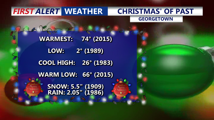
Looking back at some record breaking Christmas' in Georgetown.
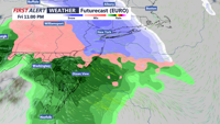
Christmas night turns colder and drier, with lows falling into the mid to upper 20s. Friday will be cloudy and raw, with highs mainly in the upper 30s to low 40s. A winter storm is expected to impact the region late Friday into Friday night, bringing widespread precipitation. While areas north of Delmarva may see accumulating snow or sleet, precipitation locally is expected to be mainly rain, though a brief wintry mix is possible, particularly across Delaware and the Mid-Shore early in the event. Light wintry precipitation could linger into Saturday morning.

Area of low pressure will impact the region late Friday night - Saturday, best chance for high impact winter weather is north of Delmarva.
Late Saturday and Saturday night will fall between systems, with mostly cloudy skies, seasonable temperatures in the upper 40s and only a slight chance of light precipitation.
Another system is expected to move in late Sunday into early Monday, bringing a milder and mostly wet pattern with widespread rainfall. The system is expected to produce mainly beneficial rain.
Behind that system, colder air pours into the region Monday as Canadian high pressure builds in. Breezy conditions are expected, with wind gusts potentially exceeding 40 mph. Wind chills could fall into the single digits Monday night. Cold and blustery weather continues Tuesday, with highs near or below freezing and lows in the 10s to low 20s. Will end the year on a cold note and begin 2026 with below average temperatures.