


DELMARVA -- Unfortunately our late July pleasant weather is coming to an end. It's back to reality. A warm and muggy night Thursday as high pressure offshore maintains a steady southwest flow. Overnight lows will remain in the low to mid-70s, making for uncomfortable sleeping conditions ahead of an even hotter Friday. Some areas of fog are possible.

Sweltering heat and humidity grips Delmarva Friday.
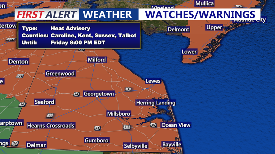
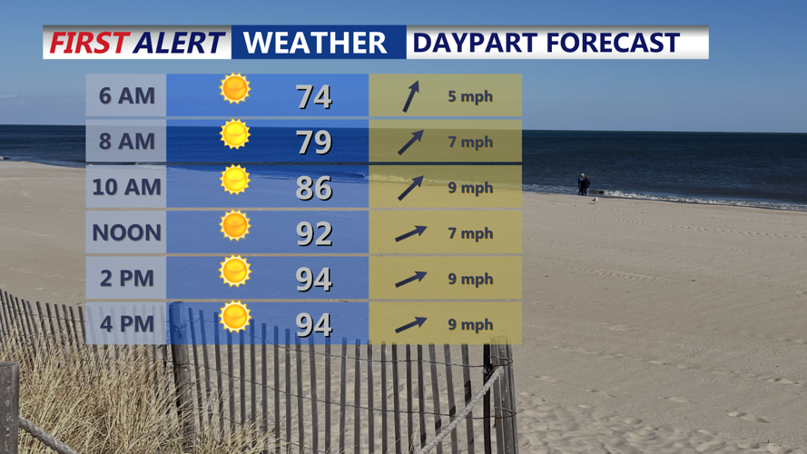
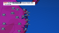
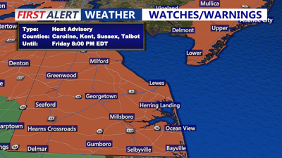
Friday’s weather will bring increased heat and humidity as temperatures climb into the mid- to upper-90s, with dew points in the low 70s pushing heat index values to between 103 and 108 degrees. The National Weather Service has issued a Heat Advisory for the day.

Feeling like 101 to 108 Friday afternoon west of Coastal Highway.
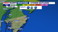
A cold front is expected to sweep into the region late Friday afternoon or evening, triggering isolated showers and thunderstorms. While the strongest storms are expected northwest of the I-95 corridor, northern Sussex County and areas north may see isolated activity before storms weaken as they move southward. Skies will gradually clear late Friday night with lows falling into the mid-70s.

Primary storm threat Friday evening will be northern Delmarva, a brief t-storm possible northern Sussex County.
Saturday and Sunday will feature an unsettled pattern as the cold front stalls south of the region before lifting back north as a warm front on Sunday. Scattered showers and storms are likely at times, but the entire weekend will not be a washout. Temperatures will remain seasonably warm, in the upper 80s to low 90s, with heat indices ranging from 90 to 100 degrees.
High pressure will return Monday, bringing the driest day of the period with mostly sunny skies. However, humidity and temperatures will increase again by midweek, leading to another round of showers and thunderstorms as yet another cold front approaches by Wednesday.


