


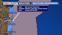


DELMARVA -- A pleasant stretch of late-summer weather continues today, but beachgoers are being warned of dangerous conditions in the surf with a high risk of rip currents.

The National Weather Service has issued a high risk for rip currents along the Delaware Beaches south through Ocean City, Md., and Assateague Island. Swim near lifeguards and follow all safety instructions.

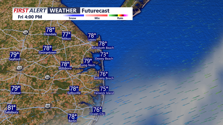
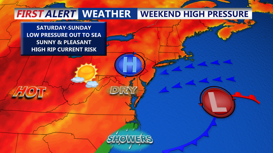
The rest of your Friday will feature a mix of sun and clouds with highs in the upper 70s to low 80s as an easterly onshore flow holds steady. The rip current threat will persist through the weekend, fueled by the combination of high pressure to the north and a storm system well offshore.
Overnight look for partly cloudy skies with lows in the 60s, with some 70s at the beaches.

By Saturday, lighter onshore winds will allow temperatures to warm slightly, reaching the upper 70s to mid 80s. Dew points will remain in the upper 50s to low 60s, keeping conditions comfortable. Overnight lows will fall to the mid 50s inland and low 60s near the coast.
Sunday is expected to deliver a picture perfect August day, with mostly sunny skies, calm winds, and highs in the mid 80s, right in line with seasonal averages.
As high pressure shifts east early next week, temperatures will climb, with some temperatures in the mid to upper 80s Monday and Tuesday, and widespread 90s by Wednesday.
The increase in heat and humidity will bring back the risk for afternoon showers and storms by midweek, with a chance of precipitation late Wednesday and Thursday.
