


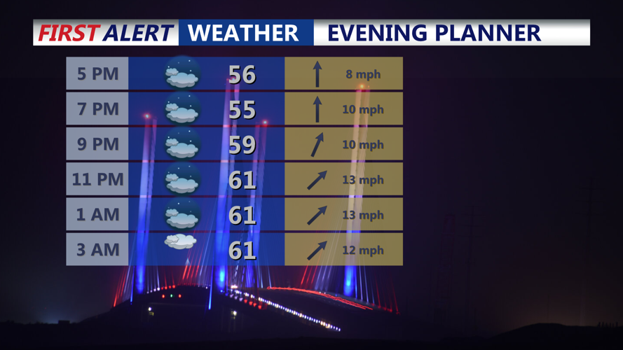


DELMARVA - A few showers overnight with increasing winds, then windy and turning colder Sunday into early next week.

This evening expect cloudy skies with temperatures falling from the 60s into the 50s with increasing winds. Showers develop later tonight as a warm front lifts through the peninsula. Rain amounts will stay light, generally under a quarter-inch, with most of the heavier activity remaining north of Delmarva. With warm air moving in, temperatures into Sunday morning hold in the 50s.

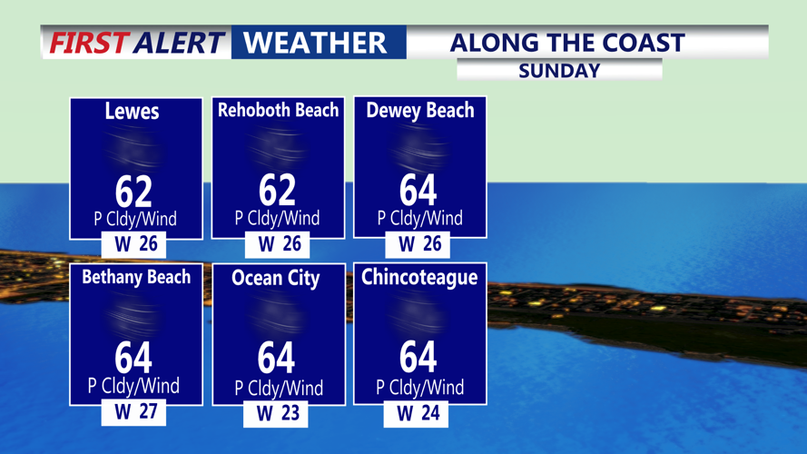
Sunday begins with scattered morning showers possible as a cold front approaches. Highs should occur by late morning or midday in the low 60s before temperatures drop sharply during the afternoon. Once the front passes, skies clear from west to east and winds turn brisk out of the northwest, with gusts of 35 to 40 mph likely. Sunday night lows fall into the mid 30s, but feeling like upper 20s and lower 30s with the wind.

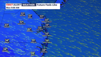
Early next week stays chilly. Monday will be blustery with highs only in the upper 40s to low 50s, feeling more like the 30s under partly cloudy skies. A weak system passes to the south on Tuesday, with an increase in clouds and highs only near 50.


A weak disturbance could bring another round of showers Wednesday and Thursday with warmer temperatures in the mid to upper 50s.
