


DELMARVA -- Low clouds and fog are gradually breaking up this afternoon across Delmarva. Expect some sunshine this afternoon, along with warm and muggy conditions. Highs in the 70s and lower 80s. A bit cooler at the coast.
This damp and humid pattern continues through Monday night, with partly cloudy to cloudy skies. Some fog could develop again late tonight into Tuesday morning. Lows in the 60s are expected.

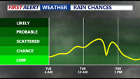
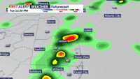
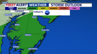
A cold front begins pushing eastward from the Ohio Valley Tuesday morning. The front will bring another round of showers and scattered thunderstorms to Delmarva, in the morning, and then again into the afternoon.

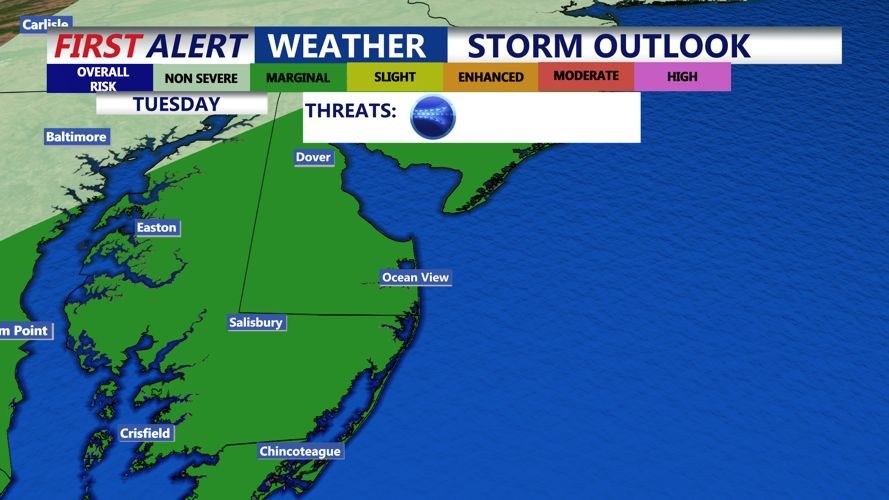
The Storm Prediction Center (SPC) has outlined the region in a Marginal Risk (1 out of 5) for severe weather Tuesday. While instability and wind shear will be limited, strong upper-level forcing could spark a few strong storms. Any severe weather that develops may be capable of damaging wind gusts, though the overall threat remains low. Rainfall totals from this system are expected to range from 0.25 to 0.75 inches.

Tuesday will bring highs in the mid 70s to low 80s, before drier air arrives late in the day. Skies begin to clear Tuesday night, setting the stage for a dramatic weather turnaround.

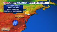
By Wednesday, high pressure will settle over the region, delivering sunshine, low humidity, and warming temperatures. Highs will climb into the low to mid-80s Wednesday, followed by upper 80s to near 90 degrees Thursday and Friday. Inland areas could see their first 90-degree readings of the year as summer-like warmth takes hold.
The weather pattern becomes more unsettled again by the weekend as another cold front drifts southward. Forecast models suggest the front could stall near the area, bringing an increased risk of showers and thunderstorms, especially Saturday. Behind the front, temperatures will trend closer to seasonal normals, or even slightly below average. Hopefully dry for Dad on Father's Day, Sunday. At this time it looks like mostly cloudy skies with temperatures in the mid 70s.
