


DELMARVA -- High pressure is sliding offshore this afternoon, with a warmer southwest flow developing for the end of the weekend.

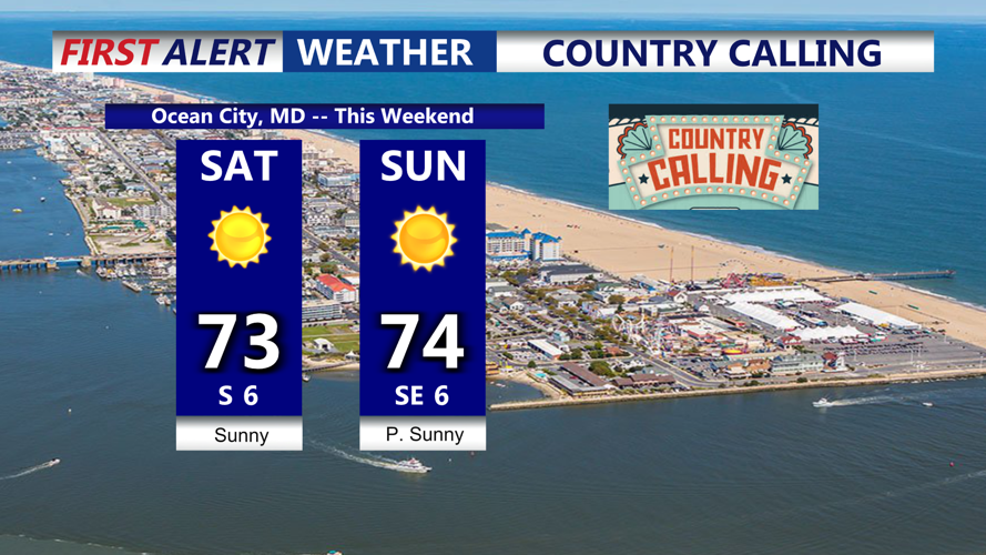
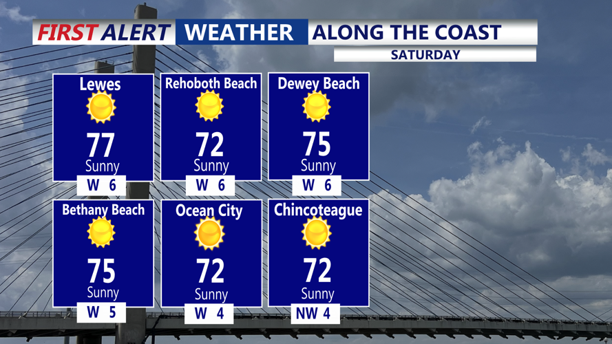
Looking great for Country Calling in Ocean City for the remainder of this afternoon and evening. Expect temperatures in the 70s, then falling into the 60s this evening under mostly clear skies.

Overnight under mostly clear skies lows will remain mild in the low to mid 50s.

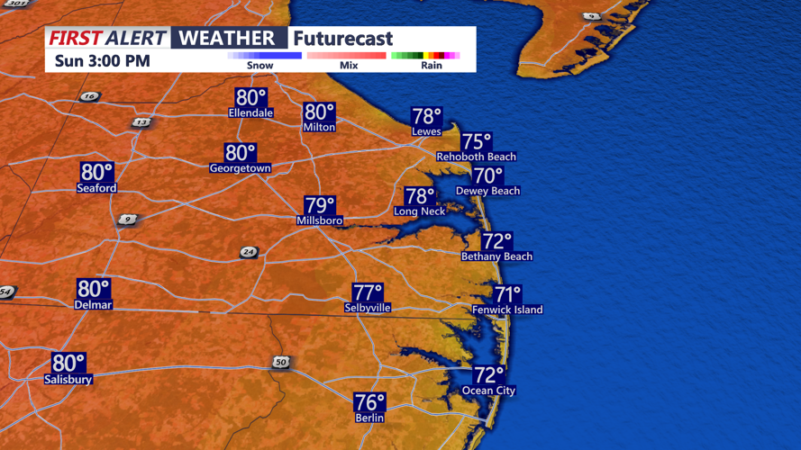
Sunday follows suit with another mostly sunny day and temperatures peaking in the upper 70s to low 80s, with cooler readings at the beaches.
By Monday, the region still feels the influence of high pressure, holding onto mostly sunny skies and highs in the mid-70s to low 80s. However, clouds begin to increase Monday night, signaling a shift in the weather pattern.

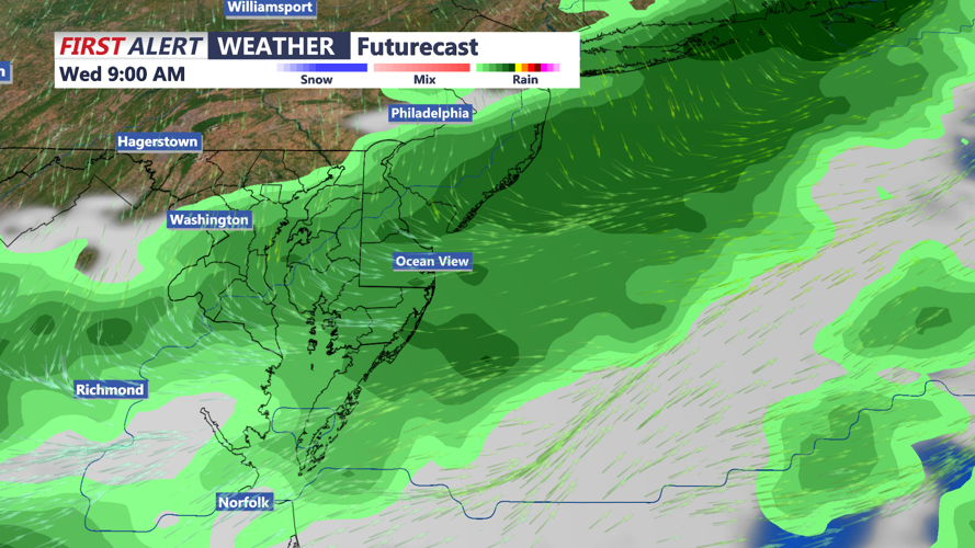
The first signs of change arrive Tuesday as an upper-level trough approaches from the Great Lakes, dragging a cold front eastward. While Tuesday will start mostly dry, clouds will build and isolated showers could develop by afternoon, especially west of the Chesapeake Bay. Showers become more widespread Tuesday night and into Wednesday as the front crosses Delmarva, with periods of steady rain possible.
Temperatures will cool notably midweek. After Tuesday’s highs in the upper 70s to low 80s, Wednesday will struggle to reach the mid-60s to low 70s under cloud cover and rain. By Thursday, behind the front, highs will fall further into the upper 50s to mid-60s with overnight lows dipping into the 40s.
