


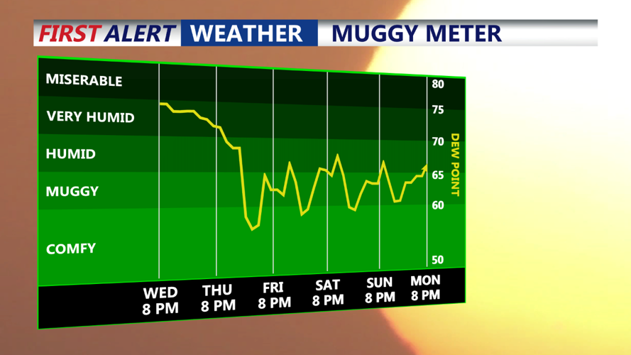


DELMARVA - Showers will persist into the overnight hours as the cold front approaches from the northwest. The presence of a weak surface low may enhance the ascent, leading to more widespread rainfall. Instability remains in the forecast, albeit limited, which may continue to restrict significant lightning activity. However, with deep-layer shear and a warm, moist environment, there is a slight risk of localized downburst winds from stronger storms. Flash flooding remains a concern due to the high moisture content in the atmosphere.
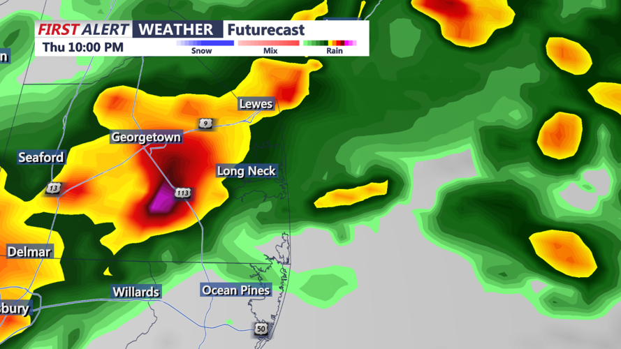
Thursday Morning and Afternoon:
Expect ongoing showers and possibly a few thunderstorms Thursday morning as the shortwave moves through Delmarva. Cloud cover will remain extensive, limiting daytime heating and thus reducing overall storm intensity. Despite this, the environment will remain conducive to heavy rainfall. Any stronger convective cores that develop could produce very heavy downpours, leading to localized flash flooding. By Thursday afternoon, the shortwave will start to move out of the region, gradually reducing the intensity and coverage of showers.
Outlook:
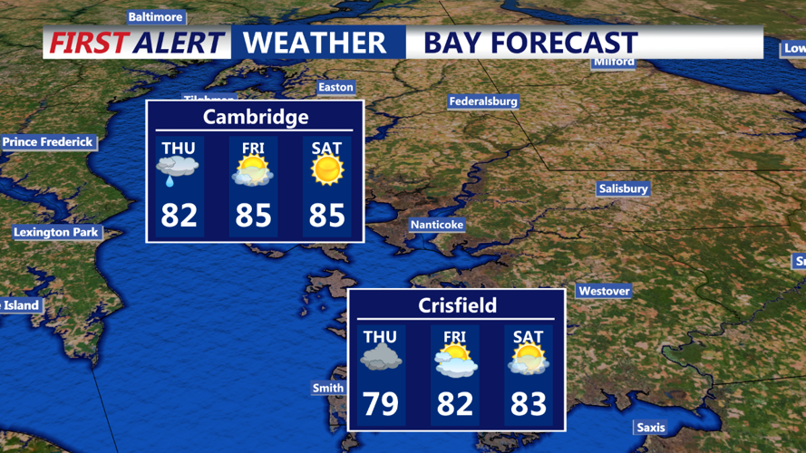
High pressure will build into the region by Friday, bringing drier and more stable conditions that will persist into the weekend and early next week. The next significant weather system is not expected to approach until Tuesday.