


DELMARVA -- High pressure slides to the east on Saturday, allowing for warmer conditions with increasing clouds. Even warmer on Sunday with more clouds and breezy conditions.
A chilly star this morning with temperatures in the upper 30s to low 40s, and while frost is not guaranteed, a few colder inland spots could see patchy frost under mostly clear skies.

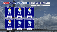
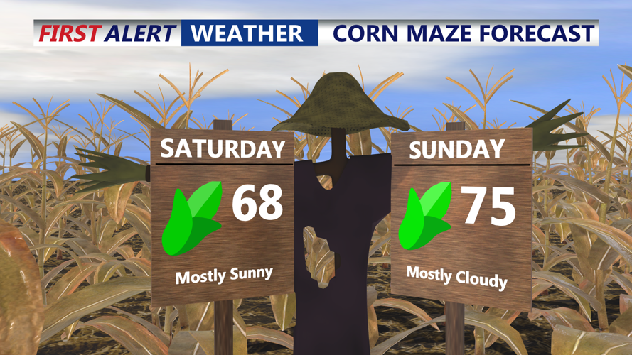
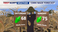
Saturday will feature a shift in the weather pattern as high pressure slides offshore and southerly flow brings in warmer air. Afternoon highs will climb into the mid to upper 60s, with some spots nearing 70 degrees. High clouds will increase later in the day ahead of a strong cold front approaching from the Midwest. Overnight lows will be milder compared to recent nights, dropping into the low to mid 50s.

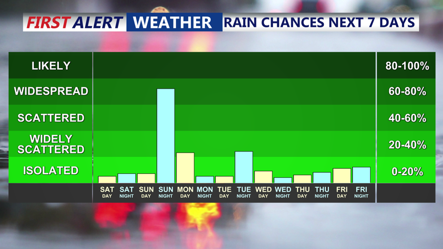
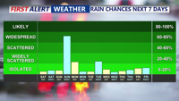
By Sunday, a strong upper-level trough will swing through the Mid-Atlantic, increasing moisture and bringing temperatures into the mid 70s despite growing cloud cover. Dew points will rise as southerly winds strengthen ahead of the approaching front. Showers are likely Sunday night, and while instability looks limited, strong upper-level support could produce a narrow band of heavier showers capable of brief strong wind gusts.

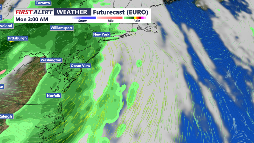
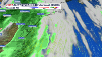
The front will clear Delmarva early Monday, but lingering showers are possible as cooler air filters in behind it. A brief period of high pressure returns Monday night into Tuesday, allowing temperatures to rebound to near 70 ahead of the next system.
Another cold front is expected Tuesday night, with another round of showers expected. Any showers end early Wednesday, with highs in the 60s.
By Thursday, a larger trough over eastern Canada will usher in cooler air once again, keeping temperatures seasonable and conditions brisk into the latter part of the week.
