


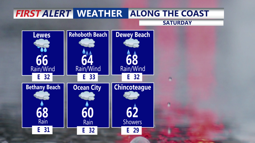


DELMARVA - Today will be the wettest and chilliest day of the holiday weekend. East-northeast winds will be sustained at 15 to 20 mph, with gusts around 25 to 30 mph. Seas will build to 4 to 6 feet. These conditions will keep the rip current risk high along the coast. Temperatures remain in the 50s this afternoon, adding to the dreary conditions.
The beaches will continue to face dangerous conditions. A high risk of rip currents remains in place for the Delaware, Maryland, and Virginia coasts. Ocean water temperatures remain mainly in the 50s to low 60s, which can quickly lead to hypothermia or physical incapacitation for anyone suddenly immersed in the water. Beachgoers should avoid entering the surf and stay alert to posted warnings.
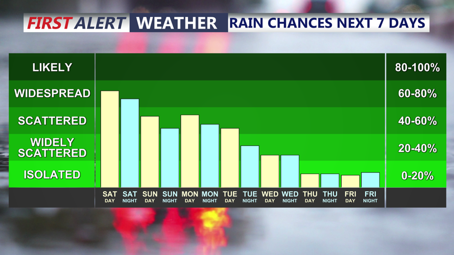
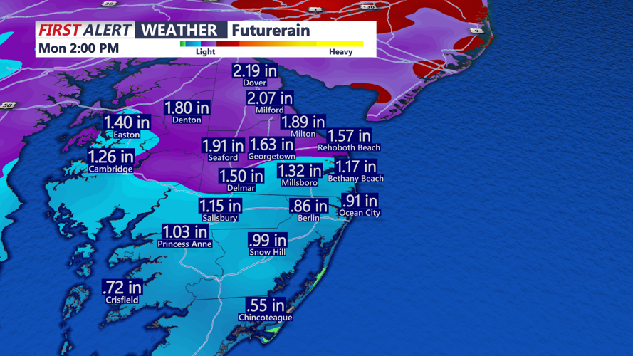
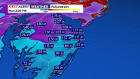
Some embedded heavier rain is possible, but the thunderstorm risk remains very low. Rainfall totals into Sunday are expected to reach 1 to 2 inches, with overall totals of around 1.50 to 2.50 inches possible over the next three days. While the timing is not ideal for the holiday weekend, the rain will be beneficial as long-term drought conditions continue across the region.
By Sunday, rain and showers should gradually taper off. Temperatures may recover slightly, but they will likely remain below average. Some drier conditions are possible by Sunday afternoon.
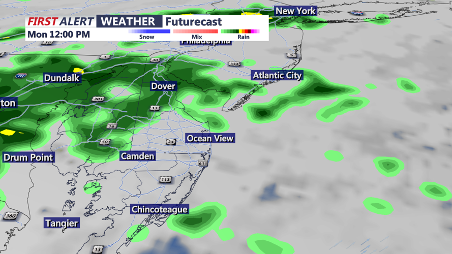
Memorial Day will be warmer, though not completely dry. The active pattern is expected to continue early next week, with a few showers still possible at times Monday. How warm it gets will depend on cloud cover and how widespread any showers become.
