


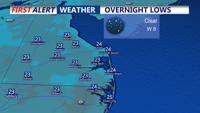


DELMARVA - Tonight you can expect a biting Arctic chill as high pressure from Canada settles into the region. Temperatures will drop into the lower 20s, under starry skies, while a west-northwest breeze will drive wind chills down into the lower teens into Sunday morning.

Dipping into the lower to mid 20s tonight.
Sunday will remain cold, with highs reaching only the low to mid-30s. A gusty west-northwest breeze will persist, keeping wind chills in the 20s. Skies will stay partly cloudy, though less extensive cloud cover is anticipated compared to Saturday. Clouds will increase through the evening ahead of our snowstorm Monday.
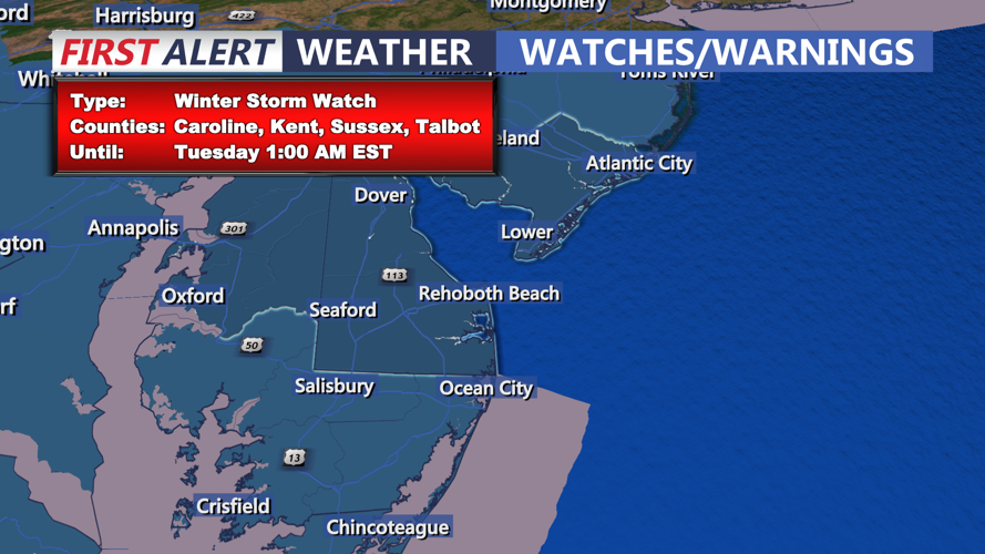
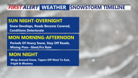
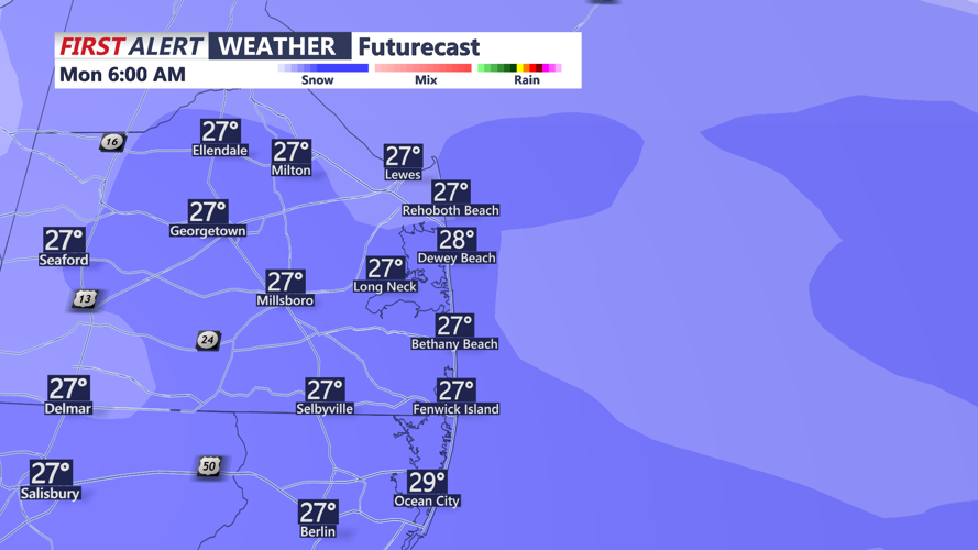
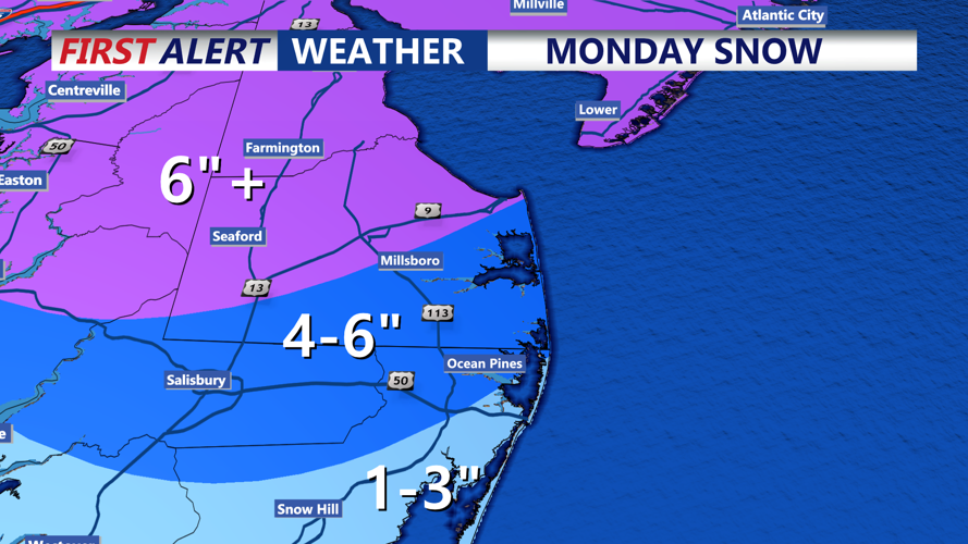
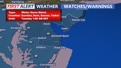
The focus shifts to Monday as a potent winter storm moves into the Mid-Atlantic. A Winter Storm Watch will go into effect early Monday morning, likely upgraded to a warning by Sunday. Snow is expected to arrive after midnight, spreading from southwest to northeast. The heaviest snow will likely fall during the morning commute, with snowfall rates exceeding 1 inch per hour in some areas.

Snowstorm Timeline
Strong mid-level frontogenesis combined with warm air advection could lead to heavier snow bands, particularly across Delmarva. Snow totals are forecast to range from 5 to 10 inches, with slightly lower amounts of 4 to 6 inches near Salisbury and Ocean City. Milder air moving into southern Delaware may cause a mix of sleet and freezing rain, reducing snowfall accumulation in areas along the coast.

Could see snowfall rates up to an 1" an hour Monday morning.

Some areas could see up to 10" of snowfall by Monday night.
The snow will taper Monday afternoon but could intensify again Monday night as an upper-level trough passes through. Winds will increase overnight, leading to blowing and drifting snow. By Tuesday morning, wind chills could drop into the single digits.
Tuesday will remain bitterly cold and windy, with highs in the upper 20s to low 30s. Northwest winds gusting up to 30 mph will keep wind chills a good 10 degrees below actual temperatures.
Looking ahead, cold and dry high pressure will dominate the rest of the week, keeping snow on the ground and wind chills below freezing. Highs will gradually climb into the mid-30s by Friday. However, we are monitoring another potential snow event for next weekend, but let's get through this storm first!
