


DELMARVA -- Winter Storm Watches will likely be upgraded to Winter Storm Warnings.
Today begins with sunny skies, but the bitter cold will be unrelenting. Morning temperatures will feel like the teens due to west-northwest winds gusting 20 to 25 mph. Highs are expected to reach the low to mid-30s, though wind chills will remain in the 20s. Clouds will increase late in the afternoon and into the evening as a significant winter storm approaches.
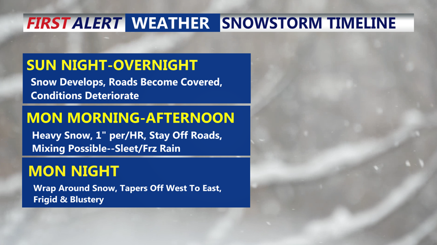
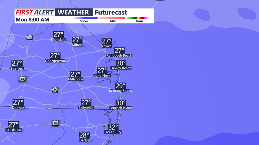
Snow is forecast to begin after midnight, spreading from southwest to northeast as a low-pressure system moves eastward from Tennessee and Kentucky. The heaviest snowfall is expected Monday morning, potentially coinciding with the morning commute. Snowfall rates could exceed 1 inch per hour in some areas due to strong mid-level frontogenesis and warm air advection.

Could see snowfall rates up to 1" per/hr Monday morning.
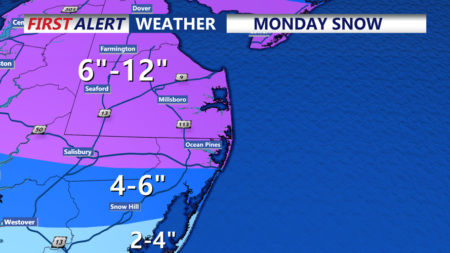
Snow totals across Delmarva are expected to range from 4 to 6+ inches, with higher amounts reaching 12" in some spots across Sussex, Kent Counties and the Eastern Shore. Along the southern coast, including areas south of Lewes, Delaware, milder air could bring a mix of sleet or freezing rain, which may reduce snow accumulation.

Some areas on Delmarva could see upwards of 12".
Snow will taper off Monday afternoon but may intensify again Monday night as an upper-level trough moves through the region. Winds will strengthen overnight, leading to blowing and drifting snow. Temperatures Monday night will drop into the teens and low 20s, with wind chills making it feel more than 10 degrees colder.
By Tuesday, the storm will move offshore, but the region will remain under the influence of cold high pressure. Winds of 15 to 20 mph, with gusts up to 30 mph, will keep conditions bitterly cold. Highs will reach the upper 20s to low 30s, but wind chills will stay in the single digits and teens.
The cold weather will persist through the week, with highs only reaching the mid-30s by Friday. Gusty northwest winds will continue, keeping wind chills below freezing and ensuring the snow remains on the ground. As we approach next weekend we are monitoring the potential for another snow event/coastal storm, though details remain uncertain.
