




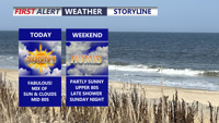
Delmarva will enjoy mostly dry and seasonable weather through Saturday before showers, thunderstorms and a heavy rain threat increase Sunday into Monday.
From
To

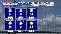
Sussex County will see dry, comfortable weather from early Saturday through early Sunday before storm chances increase Monday.

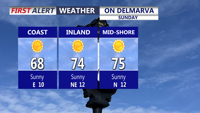
Delmarva stays sunny, dry, and breezy today with highs in the low 70s inland and upper 60s along the coast. A high risk of rip currents remains in place, with northeast winds gusting up to 25 mph and waves of 3 to 5 feet.

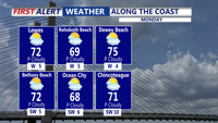
This morning we're seeing more in the way of cloud cover due to a weak cold front moving through Delmarva.

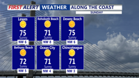
A beautiful Sunday afternoon for Delmarva, with sunshine and temperatures in the low 70s.

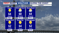
A cool and breezy Sunday afternoon is in store for Delmarva, with temperatures slowly rising through the 50s and into the low 60s, under mostly sunny skies.

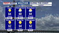
Skies clear overnight, with a chilly breeze and temperatures falling into the low to mid 40s by Sunday morning.


Worcester County officials are warning that ongoing dry conditions have increased the risk of fast-spreading outdoor fires and are urging people to delay non-essential burning.

Sussex County, Delaware, is expected to see a few showers early Friday morning and again at times during the day before drier, calmer weather settles in Friday night into early Saturday morning.

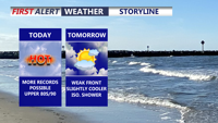
Today marks the third straight day of record-setting heat potential across Delmarva, with highs reaching the upper 80s to around 90 under partly cloudy skies. Dry air, gusty southwest winds, and ongoing drought conditions will also create an elevated fire weather risk. A weak front brings only slight cooling Friday, while a sharper cooldown arrives over the weekend with much-needed rain late Saturday night into Sunday. Early next week turns significantly cooler, with frost or even freeze conditions possible by Monday night into Tuesday morning before temperatures rebound by midweek.