




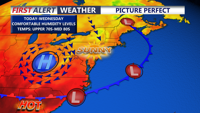
Delmarva enjoys another pleasant day today before a warm front brings increasing humidity and periods of rain and thunderstorms Thursday and Friday.
From
To

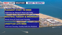
Delmarva will start the week with partly cloudy skies and highs in the mid to upper 80s. A cold front crossing the Peninsula Monday afternoon and evening could spark scattered showers and thunderstorms, with locally heavy rain possible. Tuesday turns less humid before another front brings a renewed chance for storms Wednesday night into Thursday.

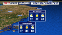
Hot, humid weather will dominate Thursday, with only a slight chance of a late-day shower or thunderstorm.

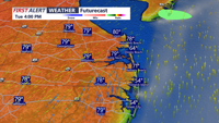
Sussex County is expected to stay warm and mainly dry from early Tuesday into early Wednesday, with only a limited chance of a passing late-day shower or storm Tuesday.

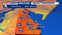
Sussex County should see a mild late Monday evening, a warmer Tuesday and only a limited chance of late-day showers or a weakening thunderstorm.

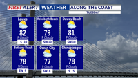
Sussex County will see warm, humid conditions Tuesday before showers and isolated thunderstorms develop late Tuesday and continue into early Wednesday.

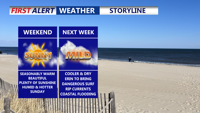
Delmarva will enjoy a warm but not overly hot Saturday, with highs in the 80s inland and 70s to low 80s along the coast. Humidity will remain elevated ahead of a Sunday cold front, which could bring an isolated shower late Sunday-early Monday. Cooler, drier conditions are expected early next week, we continue to monitor Hurricane Erin for possible coastal impacts starting Monday.


Delmarva will see a seasonably warm weekend as a stationary cold front lingers over the Mid-Atlantic. A few isolated showers and thunderstorms are possible Sunday evening before drier, cooler air settles in early next week. We continue to monitor Hurricane Erin, which could bring rough surf, dangerous rip currents, and minor coastal flooding to the region starting Monday.

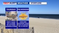
Thursday on Delmarva will be warm and muggy under partly sunny skies, with highs ranging from the mid-80s to lower 90s. Scattered showers and thunderstorms are expected to develop in the afternoon and evening, and while severe weather is not anticipated, some storms could bring locally heavy rain and minor flash flooding. A weak cold front will move through, settling south of the region Thursday night. Conditions gradually dry out Friday and Saturday, though a stray shower or storm remains possible. Another cold front arrives late Sunday, followed by cooler, less humid air early next week.


Delmarva will experience humid, foggy nights and a stretch of unsettled weather through midweek. Beginning Sunday night, areas of mist and patchy fog will develop, especially along the coast. A cold front approaching late Monday will trigger showers and thunderstorms, with the primary concern being heavy rain and flash flooding. While the severe thunderstorm risk is low, locally gusty winds cannot be ruled out. The front is expected to stall through Wednesday, keeping rain chances high before heat and humidity surge again later in the week.