


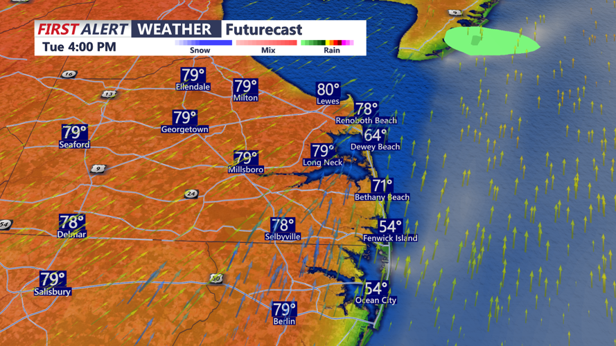


DELMARVA - A warming pattern is expected to hold from early Tuesday into early Wednesday, bringing springlike temperatures, a mild and somewhat humid Tuesday night, and only a limited risk of a shower or thunderstorm before the middle of the week.
Southwest flow will continue to draw warmer air into the region Tuesday. Highs inland in Sussex County should reach the upper 70s to around 80, while beaches and nearby coastal communities are likely to stay about 10 degrees cooler because of the colder Atlantic Ocean.
A few showers or storms could develop from Tuesday afternoon into Tuesday night, but the forecast indicates most of that activity should remain north and west of Sussex County, with any storms that do move in expected to weaken. That should leave much of the county with a largely quiet stretch through Tuesday evening.
Tuesday night into early Wednesday should stay mild, with lows only falling into the low to mid-60s and humidity remaining elevated for late March. A backdoor cold front is expected to approach later Wednesday, but that looks to arrive after the early part of the day in Delmarva.