


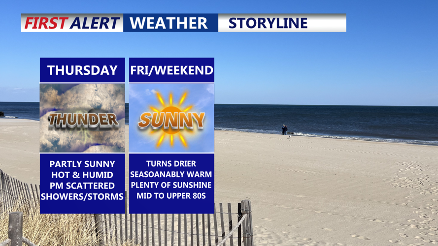
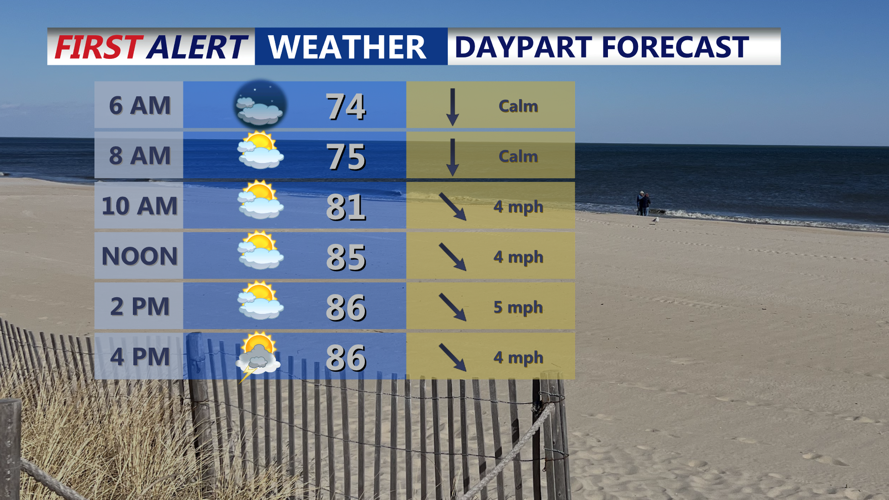


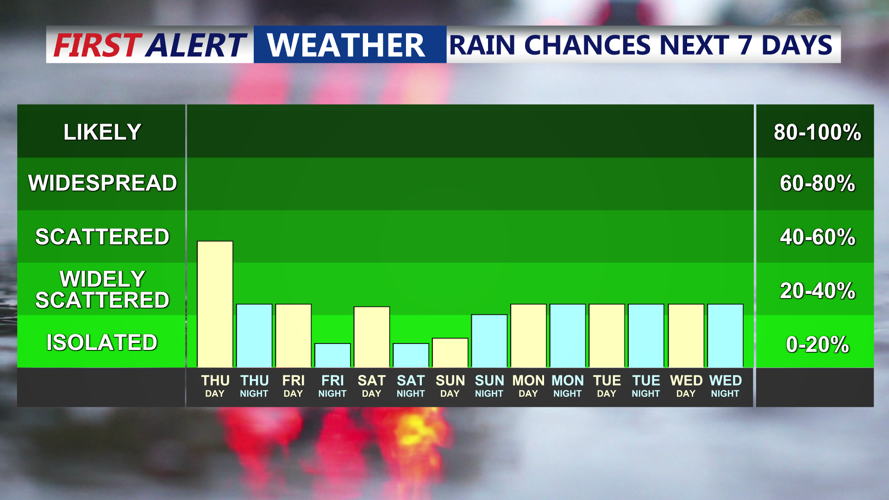


DELMARVA -- Thursday will bring another warm and humid day across Delmarva, with afternoon highs reaching between 85 and 92 degrees.

Some early fog possible, partly sunny highs upper 80s to low 90s, scattered downpours develop afternoon-evening.
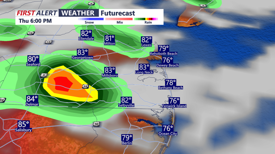
Partly sunny skies during the morning will give way to increasing clouds as scattered showers and thunderstorms develop through the afternoon and evening. Severe weather is not expected, but some storms could produce locally heavy rainfall, raising the potential for minor flash flooding in areas where the heaviest cells form.

Scattered downpours Thursday afternoon may be produce some locally heavy rainfall.
A weak cold front will move through the region from the northwest, settling just south of Delmarva by Thursday night. Any evening storms should taper off or move out of the area.. Some slightly drier air may filter in from the north overnight, especially in northern parts of the peninsula. Patchy fog is possible, though confidence is low.

Scattered showers and storms today, looking drier Friday through the weekend.
Friday will see high pressure sliding to the north, helping to dissipate the stalled front to the south. Humidity levels will drop slightly in northern areas, but warm and somewhat muggy conditions will persist, with highs in the upper 80s to near 90 degrees away from the coast. Most of the day will be dry, but an isolated shower or thunderstorm cannot be ruled out during the afternoon.
Saturday will remain seasonably warm and humid, with highs in the mid to upper 80s, cooler along the shoreline.
Looking ahead, Sunday will be hot and humid once again, with highs in the upper 80s to low 90s, before a late-day cold front sweeps through. While the front is expected to bring only a low chance of showers or thunderstorms, it will usher in a noticeable change. By Tuesday and Wednesday, high pressure from the northwest will bring cooler, less humid air to Delmarva, with dew points dropping into the 60s and even upper 50s for some areas.