



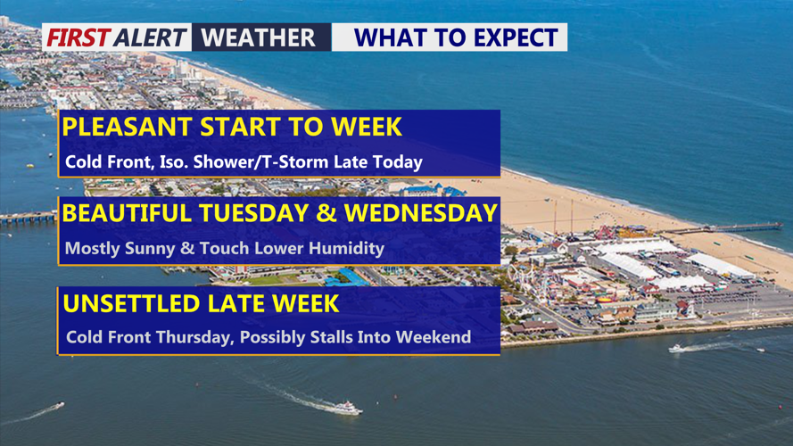
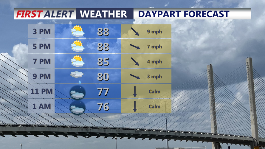
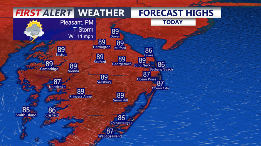

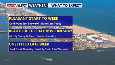
DELMARVA -- A pleasant start to the workweek is underway across Delmarva today, with partly cloudy skies and afternoon temperatures climbing into the mid to upper 80s. Humidity will increase through the day ahead of a cold front expected to cross the Peninsula during the afternoon and evening.

Partly cloudy skies, highs in the upper 80s, chance of a shower and t-storm.
As moisture builds, dew points will rise into the 70s, creating a noticeably more humid feel. Scattered showers and thunderstorms may develop as the front moves through, and some storms could produce brief, locally heavy rainfall. However, atmospheric conditions are not expected to favor widespread organized severe thunderstorms.

Highs today in the mid to upper 80s.
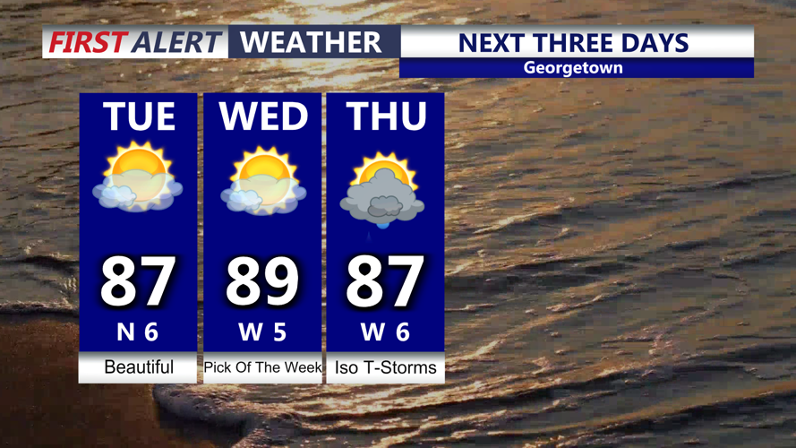
The front will move offshore Monday night, allowing slightly drier and more comfortable air to spread across Delmarva for Tuesday. Tonight will fall into the low 70s. On Tuesday, temperatures will remain warm, with highs again reaching the upper 80s in many locations, but dew points falling into the mid 60s should make conditions feel noticeably less humid.

Mostly sunny skies Tuesday and Wednesday with slightly lower humidity levels, turns unsettled Thursday.
Weak high pressure will remain over the area Tuesday and much of Wednesday, providing Delmarva with a brief stretch of mainly quiet weather. Wednesday will remain warm, with afternoon highs generally in the upper 80s to around 90 degrees as humidity gradually begins to increase again.
Attention then turns to another cold front approaching Delmarva late Wednesday. The front is expected to cross the Peninsula Wednesday night into Thursday, bringing another round of showers and thunderstorms.
There is still some uncertainty regarding exactly when the front will move through. A faster passage would bring the majority of the rain and storms overnight Wednesday into Thursday morning, while a slower-moving front could allow unsettled conditions to linger farther into Thursday.
That timing will also determine whether there is any increased concern for stronger thunderstorms or locally heavy rainfall. For now, rain chances are expected to peak Thursday, with scattered to numerous showers and thunderstorms possible across Delmarva.
Temperatures should turn cooler behind the front late in the week, with highs generally dropping into the low to mid 80s. Overnight lows could fall into the upper 50s and 60s, providing a noticeably cooler feel compared with the beginning of the week.
The weather pattern may remain somewhat unsettled heading into the weekend. The front could stall just south of Delmarva while areas of low pressure track along it, keeping occasional shower and thunderstorm chances in the forecast. Confidence remains lower regarding the exact timing and coverage of any weekend rain.
