


A warming trend is expected to carry through late Tuesday evening in Sussex County, bringing milder overnight temperatures, a breezy and warmer Tuesday afternoon, and only a small chance for showers or a stray thunderstorm late in the day.
Southwest flow will keep temperatures elevated Monday night, with lows generally settling into the middle to upper 50s across the county. Skies should stay partly cloudy, and the night is expected to remain quiet for most of Sussex County.
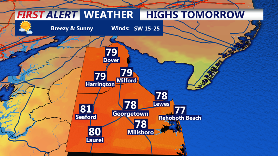
By Tuesday, warmer air will continue to build into the region. Inland parts of Sussex County could climb into the upper 70s, while communities closer to the Atlantic coast are likely to stay several degrees cooler because of the ocean’s influence. Southwest breezes and a more humid feel are expected to develop through the afternoon.
There is a chance for showers and a few thunderstorms from late Tuesday afternoon into late Tuesday evening, but the greater risk for stronger storms is expected to remain north and west of Sussex County. Any storm that reaches the county would likely be weakening as it moves in. By late Tuesday evening, temperatures are expected to remain mild, only falling into the low to middle 60s under increasingly humid conditions.